We develop new algorithms and deploy advanced platforms and sensors to:
- Enable rapid, safe, and innovative methods to help assess the condition of transportation infrastructure
- Demonstrate automated assessment of roads, bridges, traffic, and transportation corridors
- Provide remote sensing data in useful, well-documented formats that be easily integrated into transportation agency workflows
Projects
The Wireless Data Collection Retrieval of Bridge Inspection/Management Information Project: the 3D BRIDGE App
The 3D BRIDGE app is a mobile software tool designed to facilitate bridge inspection processes by enabling inspectors to collect and record element level bridge inspection data using 3G/4G network-enabled tablet devices. The overall goal is to help Michigan Department of Transportation (MDOT) reduce time needed for field staff to collect bridge inspection data, and move forward to a more efficient bridge inspection process that is available to all appropriate levels of MDOT.
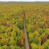
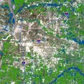
Using Multi-Temporal Imagery to Improve Mapping and Inventory of Forested Roads in Michigan's Upper Peninsula
This cooperative project between the US Department of Agriculture Forest Service and the Michigan Tech Research Institute (MTRI) developed an updated and improved roads data layer for use in ecological analysis and planning.
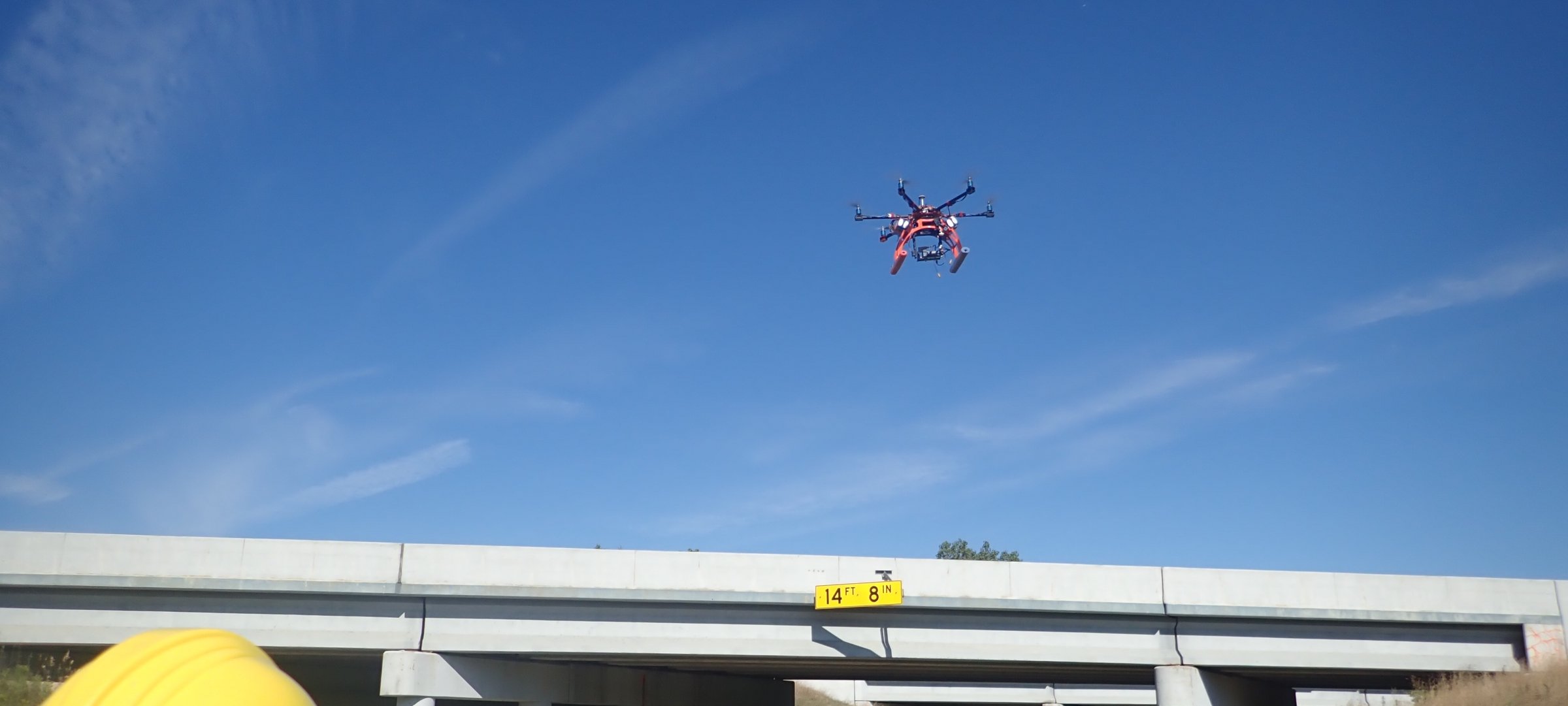
Implementation of Unmanned Aerial Vehicles (UAVs) for Assessment of Transportation Infrastructure—Phase III
The project team is working with MDOT’s bridge inspection subject matter expert along with colleagues from Collins Engineers to move UAS-enabled assessment methods into MDOT’s inspection process. The Thermal Delamination Detection Algorithm and Spallgorithm (spall detection tool) are being made into operational tools for MDOT. Multiple bridges are being analyzed every year for the duration of the project. Drones used for data collection include the Bergen Hexacopter, DJI Mavic 2 Pro, and Collins Engineers’ Flyability Elios and Falcon 8+.
Implementation of Unmanned Aerial Vehicles (UAVs) for Assessment of Transportation Infrastructure—Phase II
MTRI developed, tested, and demonstrated how UAV technology can help provide visual inspections from above for a variety of structures and locations of interest to the Michigan Department of Transportation (MDOT).
Evaluating the Use of Unmanned Aerial Vehicles for Transportation Purposes—Phase I
Objectives of the study were to develop, test, and demonstrate how Unmanned Aerial Vehicle (UAV) technology can help provide visual inspections from above for a variety of structures, locations, and roadway assets of interest to the Michigan Department of Transportation (MDOT)
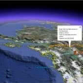
Mineral Occurrence Revenue Estimation and Visualization Tool
Under a cooperative project between MTRI and UAF, we created a flexible and map-based Mineral Occurrence Revenue Estimation and Visualization (MOREV) Tool for existing and planned Alaska and Canadian railroads, including the proposed Alaska-Canada Rail Link.
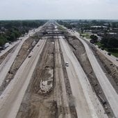
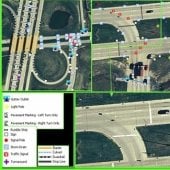
National Consortium for Remote Sensing in Transportation Streamlining Environmental and Planning Processes
We demonstrated new and innovative approaches to streamlining environmental and planning processes (SEPP) for transportation corridors by the application of commercial remote sensing data and spatial information technologies.
Transportation Applications of Restricted Use Technology (TARUT) Study
The Transportation Applications of Restricted Use Technology (TARUT) Study was a three-year effort to explore how satellite and other remote sensing data can address MDOT needs. The study combined data from fine detail, high-resolution remote sensing systems and other assets with advanced geospatial analysis techniques to examine transportation concerns.
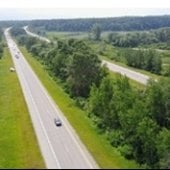
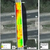
Unpaved Roads Assessment
A project team received the Phase III grant “Characterization of Unpaved Road Conditions through the Use of Remote Sensing” from the USDOT Office of the Assistant Secretary for Research and Technology (OST-R) under the Commercial Remote Sensing and Spatial Information Program. The first phase of the project led to development of a cost-effective, accurate system for inventorying unpaved roads and assessing their condition, using primarily an Unmanned Aerial Vehicle (UAV) platform, now named the Aerial Unpaved Road Assessment (AURA) system.

Bridge Condition Assessment Using Remote Sensors
Michigan Technological University’s Michigan Tech Transportation Institute (MTTI) and Michigan Tech Research Institute (MTRI), in cooperation with the Center for Automotive Research and the Michigan Department of Transportation, are undertaking a project for the USDOT Research and Innovative Technology Administration to explore the use of remote sensing technologies to assess and monitor the condition of bridge infrastructure and improve the efficiency of inspection, repair, and rehabilitation efforts. This investigation builds on existing work that places sensors directly on the bridge structure to assess deterioration and damage.
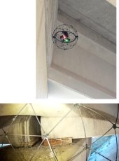
3D Optical Bridge-Evaluation System (3DOBS)
3DOBS is an easily deployable bridge evaluation system (Figure 1) used for rapidly assessing surface condition indicators such as the area, volume, and location of deck spalls and scaling.
Sustainable Geotechnical Asset Management along the Transportation Infrastructure Environment Using Remote Sensing
Developing a novel approach for the management of geotechnical assets (e.g. retaining walls, unstable slopes, rockfall sites, cut slopes, and embankments) using commercially available remote sensing system.

MDOT Bridge Scour Technology Transfer
The workshop was an overview that shared the results of the NCHRP Domestic Scan 15-02, “Bridge Scour Risk Management,” that invited national experts and peer agencies to attend to discuss current topics and trends in scour analysis, modeling, and monitoring.
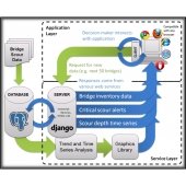
Automated Scour Detection Arrays using Bio-inspired Magnetostrictive Flow Sensors
The project used an automated magnetostrictive scour sensor whisker arrays for bridge piers, bridge abutments, and culverts for monitoring of bank stability. Data collected by the sensors will be processed remotely and information about the state of scour determined by the sensors would then be relayed to bridge owners via cellular data link. Data retrieval and visualization tools are intrinsic to the project to support decision making by bridge owners in management and maintenance decisions.
MDOT Hydrologic Calculations
Due to the increased number of extreme weather events in recent years, MTU and MTRI are working to update frequently used data sets for hydrologic calculation procedures, as well as to evaluate new procedures for potential operational use.
Learn more about this project.