
UAV Deployed Sensors
MTRI deploys multiple sensors aboard its fleet of unmanned autonomous vehicles (UAVs) to collect critical project data.
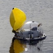
Automated Lagrangian Water Quality Assessment System (ALWAS)
Michigan Tech Research Institute (MTRI) and the University of Michigan Marine Hydrodynamic Lab’s Automated Lagrangian Water Quality Assessment System (ALWAS) is an inexpensive, free-floating, water quality measuring and watershed evaluation system. It is capable of making a wide range of measurements rapidly and easily and storing the results for later retrieval and analysis.
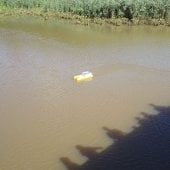
BathyBoat
BathyBoat is a cost-effective, easily deployable, and recently upgraded water depth mapping tool for restricted harbors and other hard-to-access remote locations such as bridges. The newly redesigned BathyBoat is three feet in length and weighs less than 40 pounds.
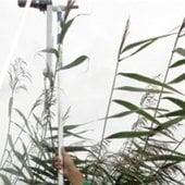
Plant Canopy Analyzer
Leaf Area Index (LAI) measurements help to parameterize the water balance in Michigan in order to obtain accurate estimations of evapotranspiration. MTRI is producing maps of LAI in the upland watersheds using modified MODIS algorithms applied to Landsat or ASTER 15-30 m data.
Software Defined Radios
MTRI has successfully implemented a three-node software-defined radio (SDR) system that records 25 MHz of bandwidth continuously on each node for up to 120 seconds.
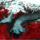
Glacier Ablation Sensor System (GASS)
The GASS was designed, fabricated and deployed to record, on a hourly basis, data describing the horizontal and vertical (melt) movement of a glacier, as well as meteorological data including temperature, wind speed, humidity, barometric pressure, and upward and downward looking light intensity.
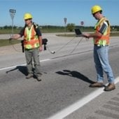
Ground Penetrating RADAR (GPR)
State of the art capabilities in subsurface (ice/soil) RADAR measurements in man-portable, multi-static, FM-CW testbed system.
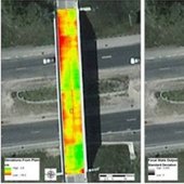
3D Optical Bridge-Evaluation System (3DOBS)
3DOBS is an easily deployable bridge evaluation system (Figure 1) used for rapidly assessing surface condition indicators such as the area, volume, and location of deck spalls and scaling.
Analytical Spectral Devices, Inc. (ASD) FieldSpec3 Spectroradiometer
The FieldSpec3 Spectroradiometer accurately measures reflectance, transmittance, radiance, or irradiance in the full spectrum range of 350-2500 nm.
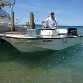
Survey Vessel Husky Traveler
The Husky Traveler is outfitted to help with field data collection that assists in submerged aquatic vegetation, bathymetry, and bottom type mapping in the Great Lakes.
Spatial Analysis Laboratory (SAL)
The SAL includes a full suite of GIS and remote sensing software, a large and scalable storage system, and large-format printing capabilities