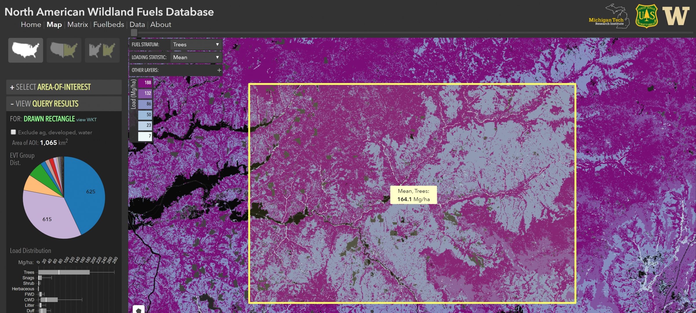
MTRI has developed numerous decision support systems (DSS) as web applications that incorporate near real-time data, custom remote sensing algorithms and imagery, and custom-developed data visualizations in support of various use cases. The systems support a range of themes including Great Lakes water quality, transportation, fire emissions, geohazards, and socioeconomics.
Projects
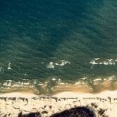
Remote Monitoring and Evaluation of Dangerous Nearshore Currents
For each Michigan State Park located on a Great Lake, a DNC Hazard Map was created based on an analysis of high-resolution aerial and satellite imagery compiled from several sources. The results of this effort are shared in the form of a web map to support public safety outreach efforts to educate Michigan beach users about this common coastal natural hazard.
Find out how the tool helps beachgoers be safer.
Phragmites Management Look-Up Table
This Look-Up Table summarizes the Mondrian model's recommended course of action to manage Phragmites under many different wetland conditions.
Dangerous Nearshore Current Dashboard
This Dashboard was developed as a resource for beach managers, emergency response agencies, local media, policymakers, and the public to better understand the hazard of Great Lakes currents.
HABs Mapping
Harmful Algal Bloom Mapping, Water Quality, and Public Health