In a study sponsored by the US Department of Transportation’s Research and Innovative Technology Administration (RITA), new and innovative approaches to streamlining environmental and planning processes (SEPP) for transportation corridors were demonstrated by the application of commercial remote sensing data and spatial information technologies. Partner research institutions led by Mississippi State University including Oak Ridge National Laboratory and the Michigan Tech Research Institute collaborated with partner DOT agencies to compare and quantify benefits of new and innovative approaches versus traditional methods for completing tasks in the Environmental Impact Statement (EIS) process. A completed EIS for a planned segment of I-69 that traverses Memphis, Tennessee, and Northwest Mississippi served as the research test bed to quantify benefits delivered by the technology deployment project. In addition, the project also addressed Hurricane Katrina lessons learned to derive nationally significant motivations toward enhanced geospatial preparedness for application to transportation planning practices.
Project Tasks/Activities
- Project scoping
- Public participation plan and process
- Develop resource agency involvement plan
- Analyze current and future projected multi-modal demand and performance
- Map the characteristics and conditions of the existing transportation systems
- Document existing and projected environmental and land use conditions
- Establish purpose and prioritize needs to meet goals
- Generate alternatives that meet goals
- Identify feasible alternatives to generate preferred alternatives
- Compile results into a corridor plan document
Project Process
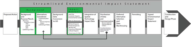
A consortium of research and agency partners conducted research guided by an FHWA and RITA organized advisory panel comprised of local and national representatives spanning the combined competencies of transportation project development processes. Key components of the research project included tasks and activities typical of a transportation corridor planning and environmental assessment process, but each activity considered how remote sensing and spatial information (RSSI) technologies could add efficiencies, reduce costs, and/or improve the quality and outcomes of the task or activity. Included was a Multi-Criteria Decision Model (MCDM) for evaluating which highway alignments have the least environmental impact. Advisory panel input ensured targeted development of key project aspects to ensure that focus was placed on activities delivered the best payoffs and ensured that the project was highly connected to relevant communities of practice and ensured that communities of practice received feedback in an ideal manner about project progress and outcomes.
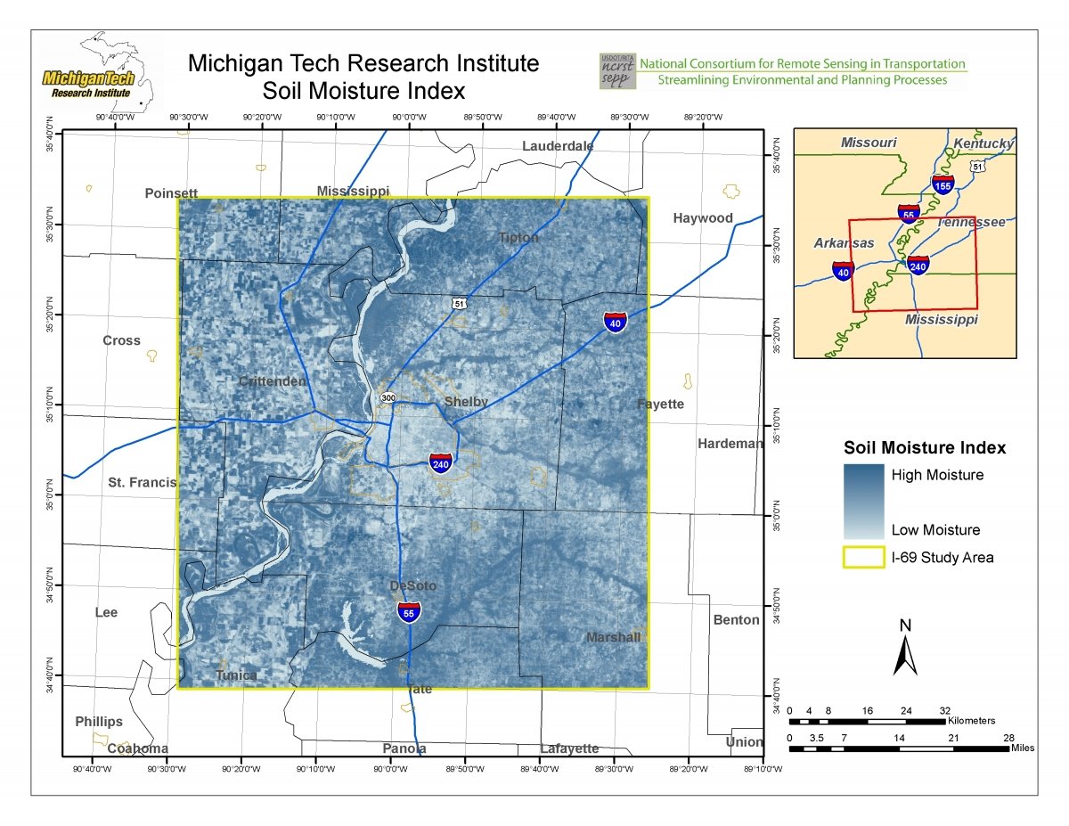
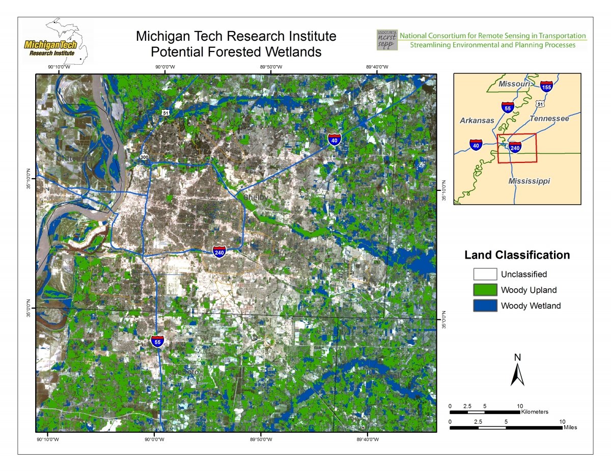
Both of these layers were inputs into the MCDM to help with avoidance of environmentally important areas. Forested wetlands have been poorly mapped using traditional methods, and improving that mapping with canopy-penetrating radar imagery is a research focus of MTRI. Areas with high soil moisture can be suitable for wetlands mitigation sites, and could be avoided by existing construction as part of reducing the environmental impacts of transportation projects.