Building from Phase II of the project, our team has focused on advancing UAS-enabled traffic operations technology, with the goal of providing live, analyzed streaming video to a Traffic Operations Center for traffic monitoring.
Use Case 1: Traffic Analysis
The project team is focusing on traffic data collection, implementing fully automatic online traffic video processing algorithms, development of real-time traffic analytics platforms, and demonstration of UAS potential for real-time traffic monitoring.
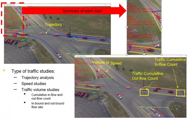
Recorded traffic flow
A two-lane freeway with traffic flowing in one direction crosses a bridge over a perpendicular divided freeway with two lanes traveling in opposite directions. Two large, circular ramps on either side of the lower freeway provide access from the upper freeway to the far side of the lower freeway and from the close side of the lower freeway to the upper freeway. A long, slightly curved off-ramp provides access from the upper freeway to the close side of the lower freeway.
Traffic flows freely, with steady but well-spaced cars, trucks, and other vehicles traveling at steady speeds, with no slowing or stopping. This view is shown for 33 seconds before the camera pans to the left, showing oncoming traffic from the upper freeway for the last five seconds of the video.
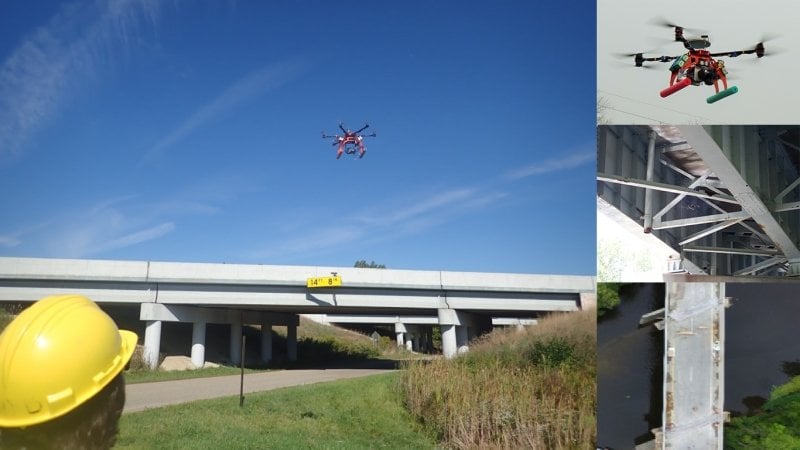
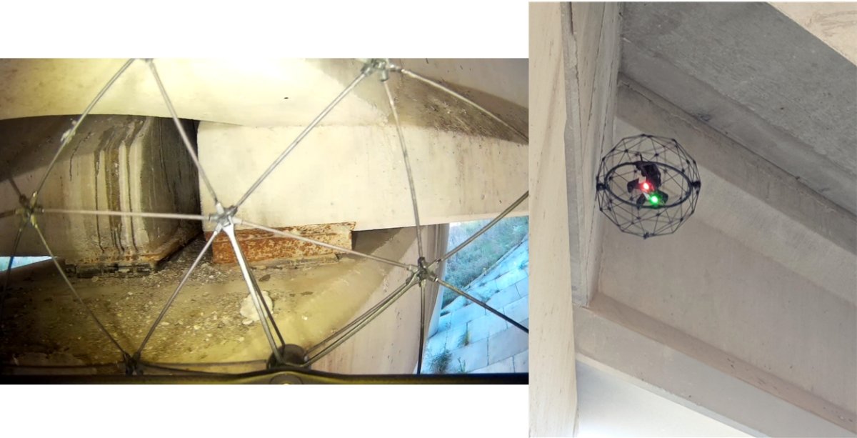
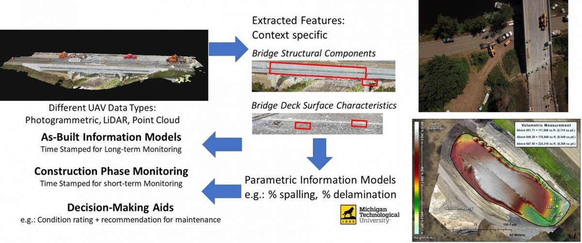
Use Case 2: Bridge Inspection Assessment
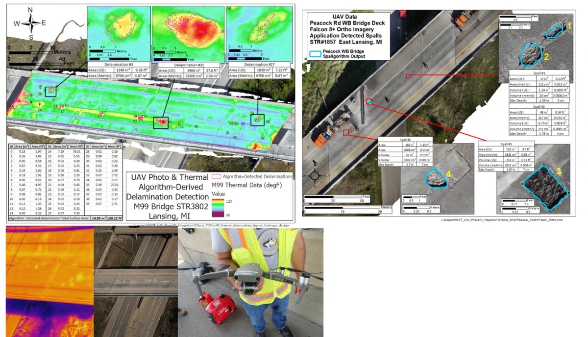
The project team is working with MDOT’s bridge inspection subject matter expert along with colleagues from Collins Engineers to move UAS-enabled assessment methods into MDOT’s inspection process. The Thermal Delamination Detection Algorithm and Spallgorithm (spall detection tool) are being made into operational tools for MDOT. Multiple bridges are being analyzed every year for the duration of the project. Drones used for data collection include the Bergen Hexacopter, DJI Mavic 2 Pro, and Collins Engineers’ Flyability Elios and Falcon 8+.
Use Case 3: Construction Inspection
The project team is focusing on continuing to use 3D optical remote sensing at active construction sites to assist field inspectors with timely identification of quantities such as aggregate cut/fills, grade changes, pavement placement data, and before-and-after data for analysis of volumetric needs. Geospatial data will be used to support MDOT’s digital project delivery process, providing accurate input to the design and construction process. During the design phase, data can be used to develop accurate alignment and profile designs using different building information modeling software.
Use Case 4: LiDAR UAS for Design Survey
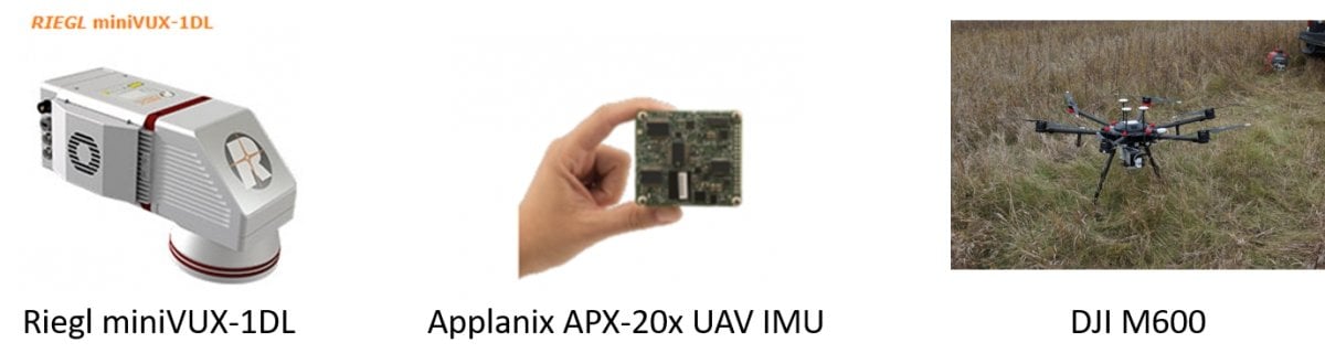
The project team is working closely with MDOT to integrate UAS-collected LiDAR data and its outputs (point clouds and DEMs) of road corridors and nearby vegetation into MDOT data sharing tools. The team is meeting with MDOT’s design survey experts to ensure that the road corridor measurements overview, DEMs, and software are of sufficient quality and are well attributed so they can be used for appropriate applications.
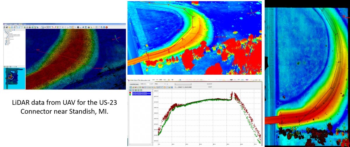
The project team, working closely with partner Surveying Solutions Inc. (SSI) to collected high-resolution UAS-based LiDAR data for the US-23 Connector project in Standish MI. This site was selected based on various criteria such as being previously surveyed to MDOT Design Survey Specifications. Data are being analyzed and compared to existing mobile LiDAR data to assess accuracies for different surface types (hard, soft, vegetated).
Equipment used during Design Survey