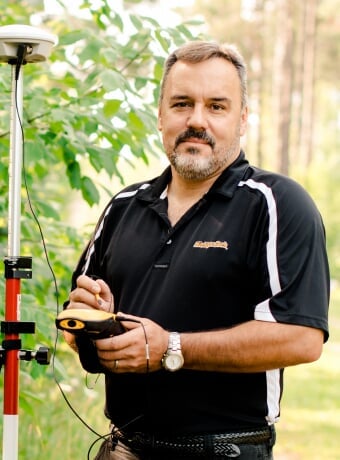
Mike Hyslop
—Mark Monmonier
- Teaching Professor
- Master of Geographic Information Science Degree Program Director
- MA, Geography, Michigan State University
- BS, Geography, Michigan State University
Geographic Information Systems
Spatial information has become a key tool for natural resource professionals. I am interested in the use of spatial technologies—GPS and GIS—and their utility in managing ever-growing amounts of data and solving resource use questions. In teaching spatial tools to others, I try to ensure my students understand the theory behind the technology so they can use it correctly, and also to instill the practical aspects and limitations of its use so they can make better decisions and communicate their results effectively to others.
I am currently studying the spatial trends of outlier populations of emerald ash borer (Agrilus planipennis Fairmaire) in Michigan. My past research has involved GIS applications in National Parks in the Great Lakes region, water supply protection, watershed analysis, wildlife habitat delineation, and modeling forest resources, invasive species and insects. My projects are not limited to plants and animals: I produce a set of maps annually to help better understand the demographics of Michigan Tech students and alumni.
I teach two classes as part of Integrated Field Practicum (IFP, better known as Summer Camp or Fall Camp) each year: Land Measurements and GPS (LM-GPS), and Geomorphology, Landscapes and Ecosystems (GeoVeg). I teach Intro to GIS (FW3540) during spring semester, and Map Design with GIS (FW4545) every other spring. At the graduate level, I teach Seminar in GIS (FW5801) and GPS Field Techniques (FW5554) in the fall, and Seminar in GIS and GIS Project Management (FW5556) in the spring.
Links of Interest
Areas of Expertise
- Geographic information systems
- Cartography
- Global positioning systems
- Great Lakes Quaternary (glacial) geomorphology