What do graduates say helped them the most in their education? Sometimes it’s a single project. Often it’s real-world research.
Many students learn through Senior Design, Enterprise, and co-op experiences. The Michigan Tech Research Institute (MTRI) offers students the chance to see research in action and learn from some of the University’s top scientists and project managers. Here are a few highlights of student research at MTRI.
Wildfire Tech
Enterprise, Senior Design, and courses specifically geared toward working with a client give Michigan Tech students that coveted “real world” experience while they’re still in college. Beyond gaining skills they’ll need in their careers, client-centric coursework connects students to potential employers and provides an extra dose of purpose to their studies.
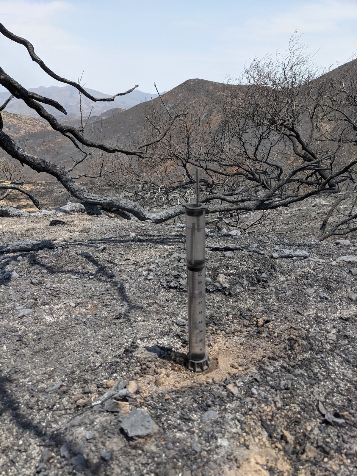
When Mary Ellen Miller, a research engineer and scientist at MTRI, went into the field during 2020, she realized that using a soil infiltrometer alone—rather than with a partner because of social distancing requirements—was much more difficult.
Watching the infiltrometer, which measures hydraulic conductivity—that is, how easily water passes through soil—while trying to operate a stopwatch and record the data proved too much for one person to do well. What Miller and soil scientists needed was an app that could record and export data in concert with the instrument. Consequently, Miller took her quandary to Robert Pastel, associate professor of computer science, who brought the problem to his user interface design and implementation class. Pastel recruits clients every year—and Miller has worked with students on four different developments since the class began more than a decade ago.
“The goal is for the students to learn how to design and implement a user interface,” Pastel says. “Our students really learn when they have clients and the users are someone other than themselves.”
The class is structured into a series of prototypes that begin with sketching an idea on paper and advance through to a functional design. Students not only learn user interface development, they learn to work with a client and user experience experts.
Bryan Wandrych, a senior software engineering major, was a member of the team that helped solve Miller’s problem. The students built a mobile-friendly website that allows scientists and engineers—including specialists on the U.S. Department of the Interior (DOI) Burned Area Emergency Response (BAER) Team—to use an infiltrometer while simultaneously recording their data with ease and efficiency.
“With this website, we automated a two-person job down to one,” Wandrych says.
The students built the app on Zoom because of the remote nature of learning during the pandemic—and they also got a crash course in soil science to be able to develop an application that met the users’ needs.
“To design the website, we had to break down the work into three programmatic levels of functionality,” Wandrych says. “Level one: Have a timer, collect data, and export as a spreadsheet. Level two: Save data and be able to review it. Level three: Do a lot more mathematics behind the scenes, like stats, polynomial regression, and curve fitting if possible—all on different timelines.”
Though the background programming was complex, the website is all smooth usability and beautiful simplicity—and its usefulness is earning attention. The DOI highlighted the student-built product during a monthly BAER meeting, and the Michigan Department of Transportation has expressed interest in integrating the website into their processes. The California Department of Forestry and Fire Protection (CAL FIRE) and the U.S. Geological Survey have also discussed using the website.
“I’m really impressed with the work the student team did this year,” Miller says. “I’m an applied scientist and I love applied tech.”
Vernal Pools
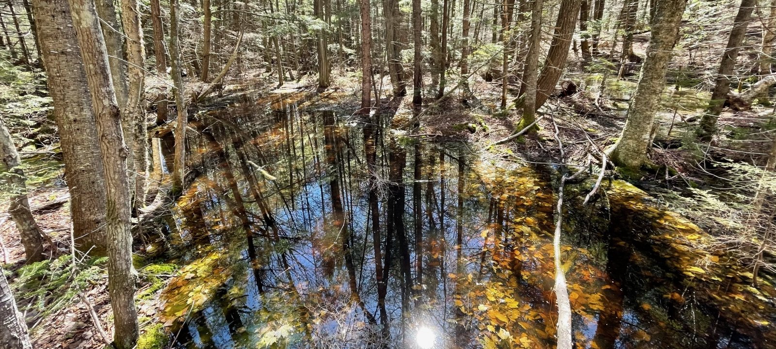
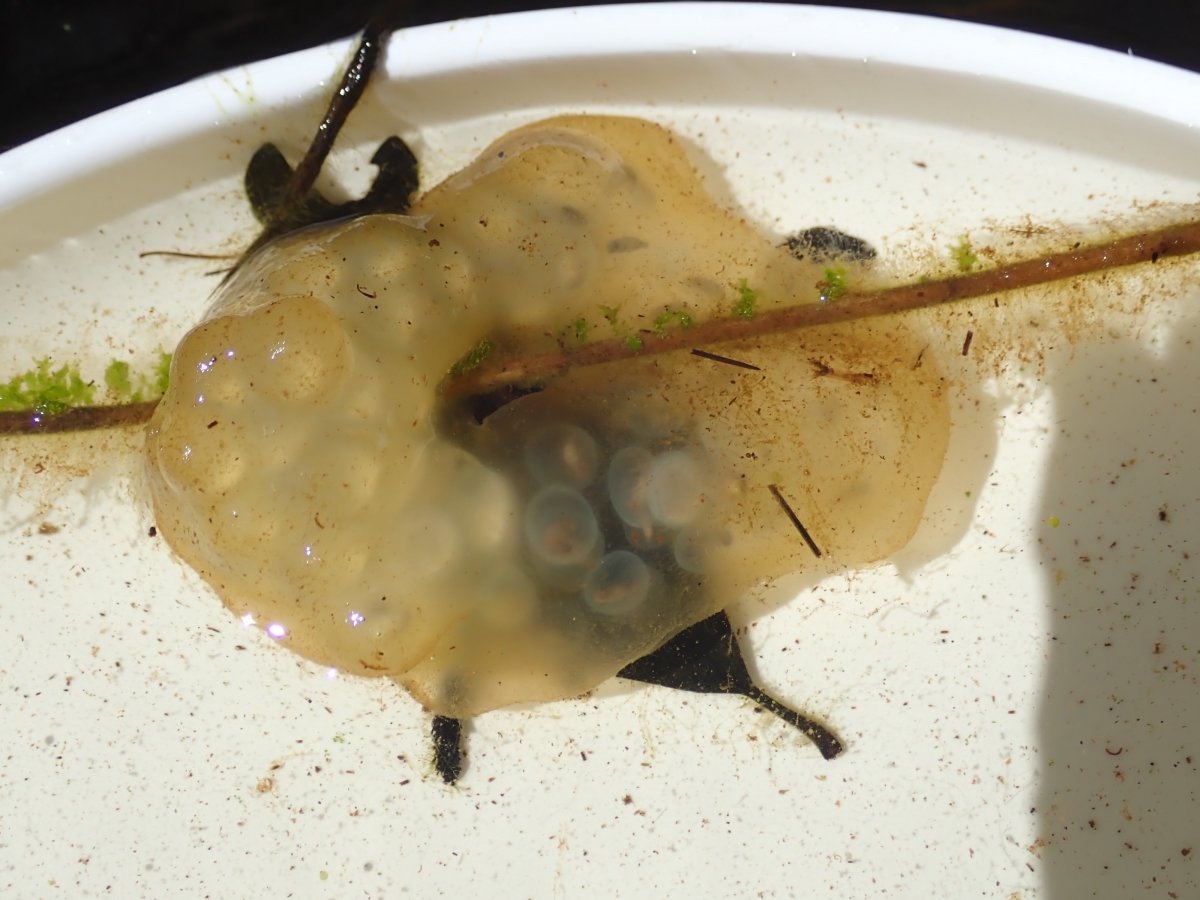
Despite their ephemeral nature, vernal pools—areas of standing water that form for just weeks every spring—provide critical forest habitat, particularly for amphibians. Vernal pools lack fish, which prey on amphibian eggs and insect larvae. In these small and often shallow water bodies, the creatures that form the foundation of the food chain start their lives.
Michigan Tech faculty and students have teamed up with research scientists at MTRI to investigate these precious pools—not only in person, by hiking to them, but also via remote sensing. Vernal pools are threatened by development and roadways. A number of national lakeshore parks—Sleeping Bear Dunes, Pictured Rocks, Isle Royale, Indiana Dunes, Apostle Islands, and Voyageurs—are keen to map the pools to protect the miniature ecosystems that thrive in them.
“There is a food chain within the pools themselves,” says Laura Bourgeau-Chavez, MTRI senior research scientist. “A lot of species go there to reproduce, then live somewhere else. If they don’t have those spaces, that’s how we end up with endangered species.”
Bourgeau-Chavez uses depressional lidar integrated with two-season radar to map from above what’s a vernal pool and what’s not. Radar works by bouncing a signal from a satellite to the ground and back. Water gives a “bright bounce” in image post-processing and allows researchers like Bourgeau-Chavez to create maps based on the information without ever traveling to the location themselves. If one of these bounces stays bright when the pool should be dry, the water body must be a wetland or a pond, not a vernal pool.
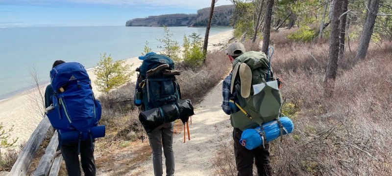
Sam Kurkowski ’21 recently wrapped up her undergraduate degree at Michigan Tech in applied ecology and will start her master’s degree in the fall. She spent several weeks this past summer ground truthing data for Bourgeau-Chavez’s lidar/radar work under the guidance of Rod Chimner, a professor in the College of Forest Resources and Environmental Science.
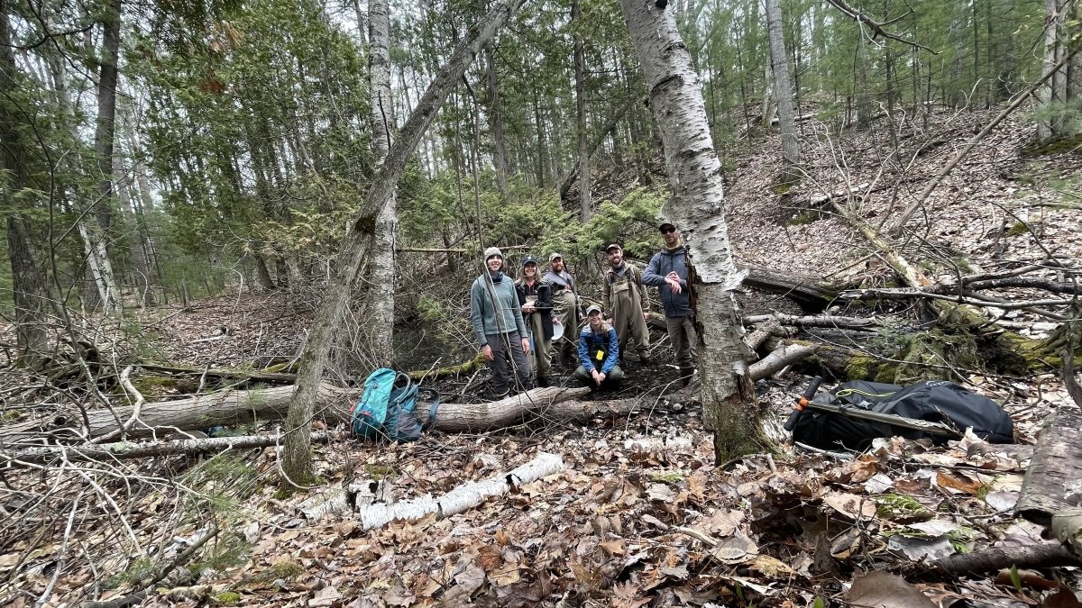
In what was a grand camping trip in some of the most spectacular locations in the upper Midwest, Kurkowski joined MTRI researchers to hunt for vernal pools, measure their size and depth, and look for indicator species.
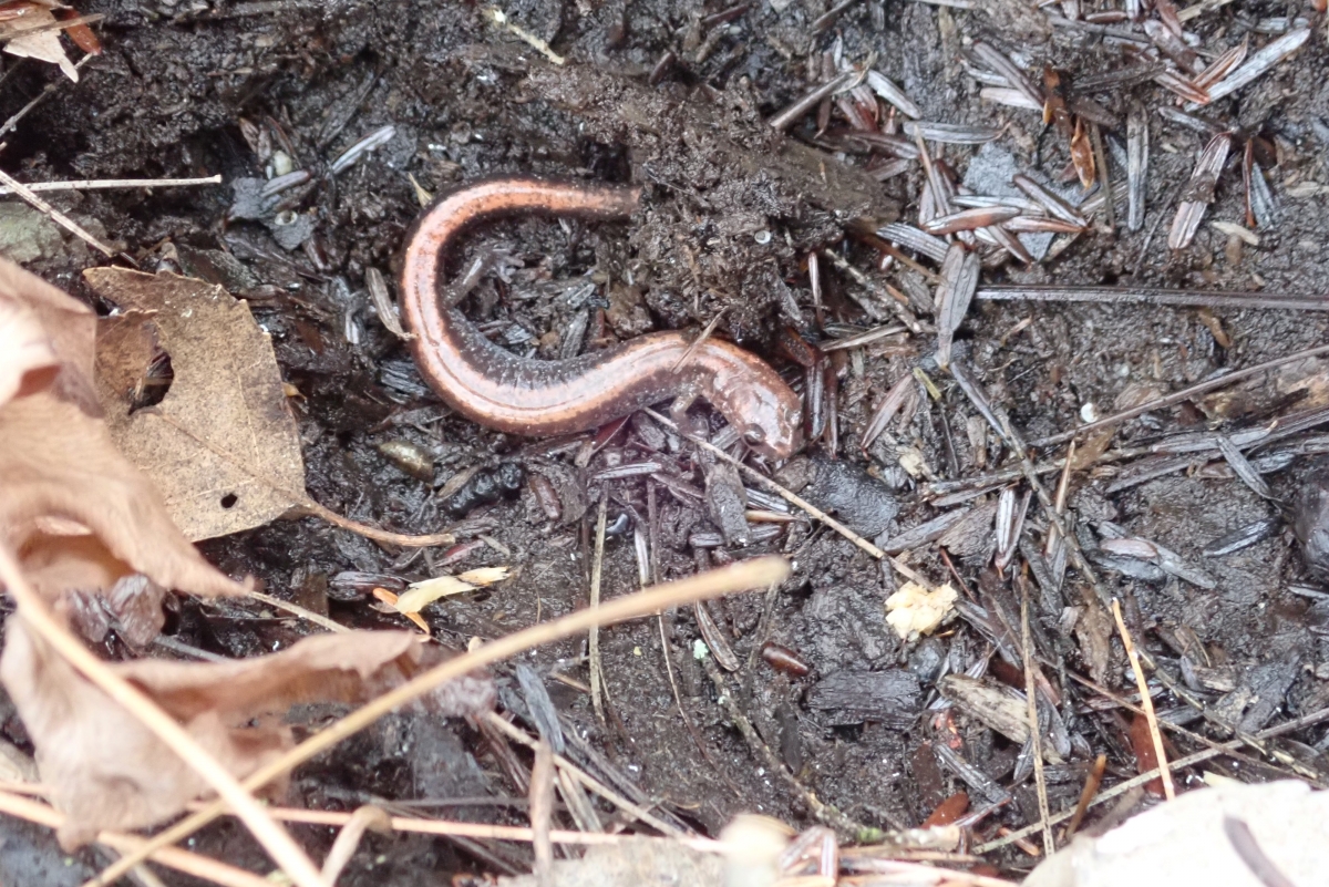
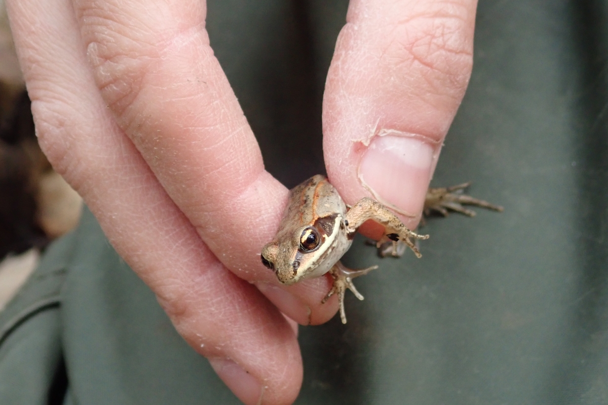
Fairy shrimp, salamanders, fingernail clams, and wood frogs are just a few of the species Kurkowski and her fellow students found in vernal pools during their fieldwork.
Kurkowski says she’s interested in patterns—do vernal pools form based on specific geology or forest type? Why do some pools provide excellent amphibian habitat while others do not?—and she looks forward to continuing to ground truth for the project next summer, returning to several sites and visiting a new one on Isle Royale.
“I love wetlands,” Kurkowski says. “I love learning about them. Even though they’re very small on the landscape percentage-wise, they are so important for vegetation, species, and water quality. It’s cool to see how something so small has a really big impact on the environment.”
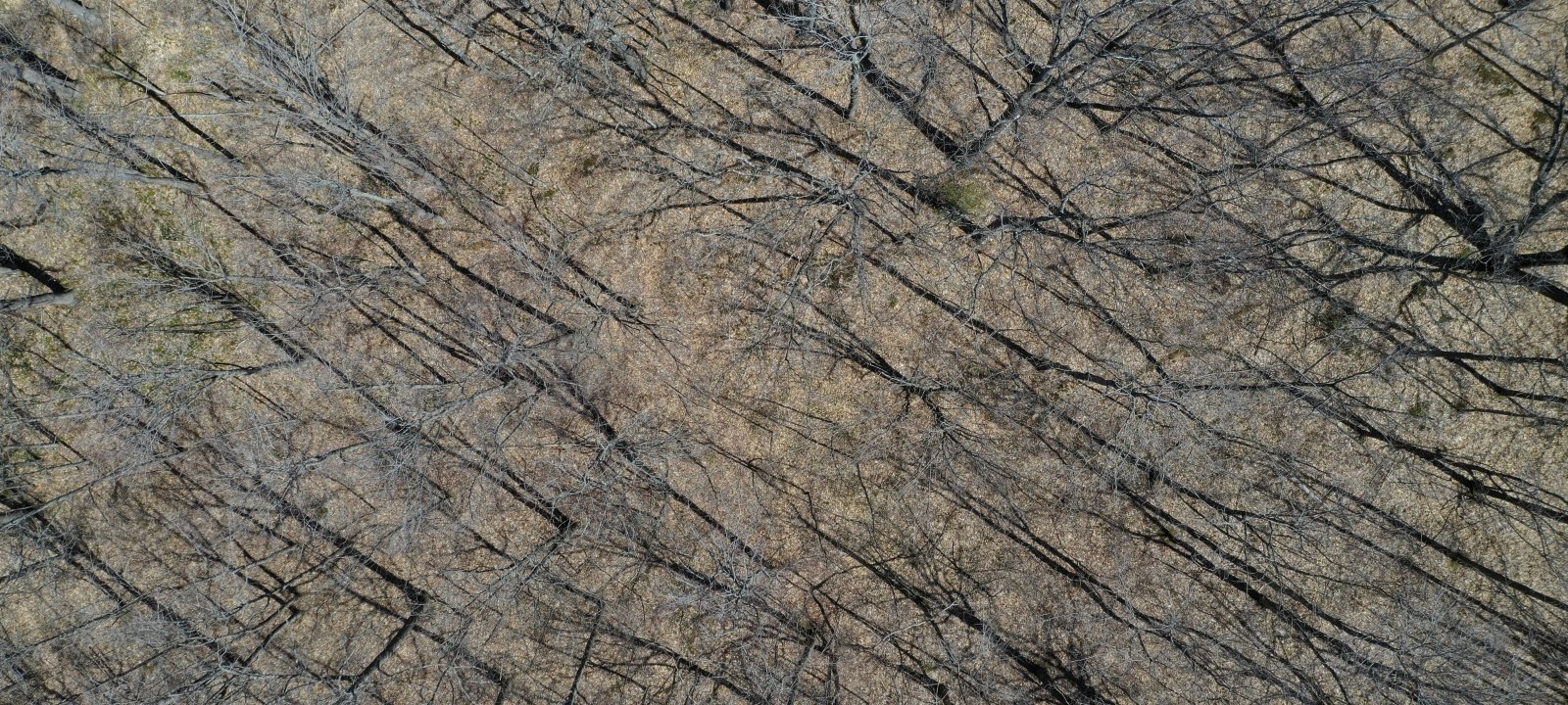
Drones for Archaeology
When you think of archaeology, what image springs to mind? Does it include bespeckled academics with floppy hats and bandannas clustered around a hole with shovels and brushes?
If that’s the case, it might be time to revisit your assumptions.
This summer, a group of Michigan Tech faculty, students, and MTRI scientists met in the Hiawatha National Forest to conduct an archaeological survey—by drone. The project was initiated by the Hiawatha National Forest in consultation with the Bay Mills Indian Community and Tribal Historic Preservation Officer Paula Carrick.
As a federal land management agency, the U.S. Forest Service has a responsibility to assess the effects of vegetation management projects on heritage resources and to collaborate with tribal governments, academic institutions, and other non-federal stakeholders to design heritage resource protection measures.
To achieve this goal, the MTU researchers worked in partnership with the U.S. Forest Service and both the Bay Mills Indian Community and the Sault Ste. Marie Tribe of Chippewa Indians to assess cultural features within the forest.
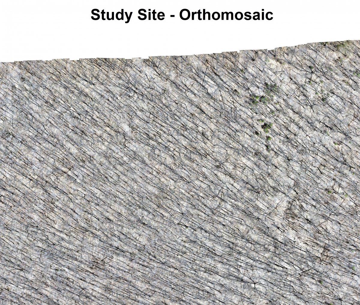
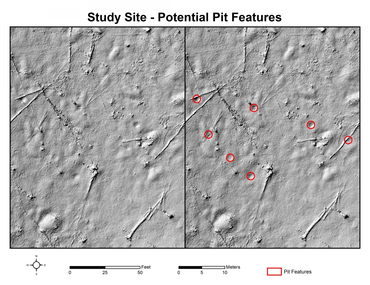
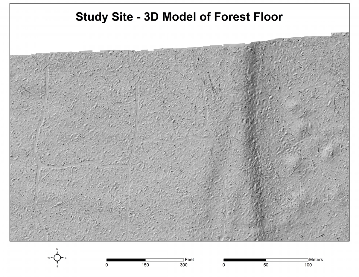
“We'll use the different survey data to build ‘bare earth’ surface models of the forest floor in the survey area,” says Tim Scarlett, associate professor of archaeology and anthropology. “While lidar and photogrammetry are essential tools for modern archaeology and cultural resources management, we don't yet know whether the camera or the laser will be better suited for this task.”
Enter Rick Dobson, MTRI research scientist, who, in addition to flying the drones (mounted with lidar sensors and digital cameras) over the forest, is evaluating the quality of the resulting models. He’ll apply new algorithmic analyses to them to identify specific types of small cultural features.
Photogrammetry provides a much higher-resolution 3D point cloud than lidar, but the advantage of lidar is its ability to “see” through the forest canopy. For example, the 3D point clouds created by lidar laser pulses have helped archaeologists find Mayan ruins in the dense rainforests of Mexico and Central America.
“Drones enhance inspections and other tasks. They make it safer and they make it more objective,” Dobson says. “The Forest Service wants to do this to preserve these features for the Native American community so loggers don’t go in and unwittingly destroy archaeological features. This survey helps to preserve and document where those features are.”
Marie Richards, a professional archaeologist and doctoral student in industrial heritage and archaeology, also works as the repatriation and historic preservation specialist for the Sault Tribe. She attended the Hiawatha survey in her professional role to watch the process and make sure human remains and cultural objects were not disturbed. She said using remote sensing methods like drone surveys helps tribal communities protect cultural sites.
“This snapshot of the area helps us understand the area going in,” she says. “The more you know going in, the less you have to disturb things. Native communities were removed from our land and our cultural landscape. As stakeholders in this project, the tribes are interested in data coming back to them to participate in land management.”
Richards, Scarlett, and Dobson hope this approach can be applied broadly across federal lands to better understand the significance of cultural features across the landscape.
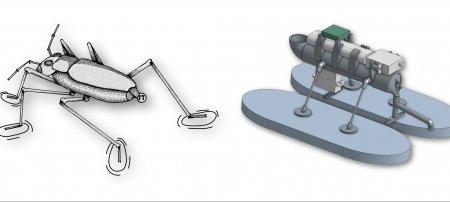
Underground Robots
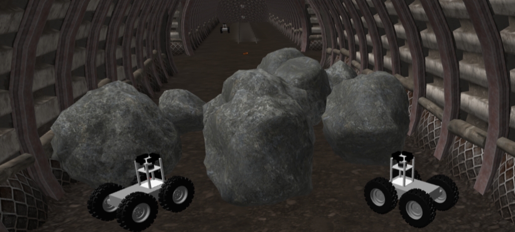
Electrical engineering major Nathan Sukaria is the newest member of the competitive robotics team BARCS, which has won awards in several rounds on the virtual track in the Subterranean (SubT) Challenge hosted by the Defense Advanced Research Projects Agency (DARPA). MTRI research scientist Sarah Kitchen leads the team, which heads into the final competition this fall—an epic interface of mining, urban, and cave simulations with $1.5 million in prizes at its end.
“The biggest challenge that helped me grow was in applying the computer skills from my courses to an actual work environment,” Sukaria says, explaining that he builds on skills in Linux and Git while collaborating. “Now I have to keep track of different branches and versions of code as they're modified in real time by other members of the team.”
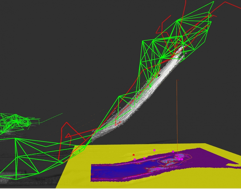
The project’s overall goal is to program robots to navigate underground, in almost total darkness and with many obstacles—a difficult feat. Kitchen’s team, including MTRI researchers Meryl Spencer and Reid Sawtell, Sukaria, and another student, works on sensing technology and how to best coordinate a fleet of robots. In an underground simulation, they have a group of drones to coordinate and accurately sense the environment, explore the space, and efficiently report back. The fleet has to find specific objects—mine shafts, subway stations, or caves—and return with clear images and the right location. The systems track and virtual track competitors do compete, but they also provide data, feedback, and modifications that DARPA’s team can use to better connect sims and real spaces.
“I have some hands-on robotics experience with the Robotics Systems Enterprise at Tech, but in my coursework I mainly learned about the basics and the theory,” Sukaria says. “The opportunity to see how teams can come together to develop robotics solutions to real-world problems has definitely helped solidify what I have learned so far in my education at Tech.”
Connected, Autonomous, and Electric Vehicles
Working with the American Center for Mobility (ACM) and U.S. Department of Energy National Laboratories, MTRI studies the energy-efficiency potential for connected, autonomous, and electric vehicles (CAEV).
“The goal of the ACM CAEV Validation Project is to provide real-world validation for algorithms and models developed that, through controlling cars' velocity with connected and autonomous car technology, would reduce energy consumption for vehicles,” says Eva Muller.
Muller knows her stuff. A computer science major with a minor in math and a member of the Aerospace Enterprise, Muller joined Bill Buller’s MTRI research group to help improve energy efficiency in real vehicles in test track conditions. Researchers have considered how cooperative driving strategies could reduce energy consumption, but there are not enough connected vehicles on the road to confirm these models with empirical measurements. Michigan Tech and ACM have a few vehicles to make measurements, and many more virtual vehicles to participate in the experiments with complex traffic interactions. The virtual vehicles exist only in simulation on a model of the test track. However, both virtual and real vehicles communicate through the network at ACM, responding to each other to create realistic traffic conditions in mixed-reality tests.
“Witnessing the inefficiency and flaws in daily transportation, it's been fun to look through these algorithms we are testing on the track and apply the different methods in my commute to Ann Arbor every day—I'm sure my bank account appreciates the money I'm saving on gas!” Muller says, adding that she finds the project’s mixed-reality approach engaging. “Setting up a virtual connected car environment that is able to implement so many real-world conditions, like road grade, network latency, and vehicle dynamics, results in a really powerful tool for the future of testing connected, autonomous, and electric vehicles.”
Muller says applying her coursework has been a rewarding challenge and, looking ahead in her career, her MTRI experiences will motivate her to take projects a step further.
“I work alongside people who come to the office or go out in the field because they are excited and passionate about their work, people who put in the extra hours because they understand the significance and potential of their research efforts, and people who continually contribute new knowledge about the world in order to solve issues encountered in daily life by real people like themselves,” Muller says. “This has motivated me to view college education as a tool rather than a piece of paper and to expand the concepts I learn in the classroom into personal projects.”
Michigan Technological University is an R1 public research university founded in 1885 in Houghton, and is home to nearly 7,500 students from more than 60 countries around the world. Consistently ranked among the best universities in the country for return on investment, Michigan's flagship technological university offers more than 185 undergraduate and graduate degree programs in science, technology, engineering, mathematics, computing, forestry, business, health professions, robotics, psychology, social sciences, humanities, and the arts. The rural campus is situated just miles from Lake Superior in Michigan's Upper Peninsula, offering year-round opportunities for outdoor adventure.