Building Coastal Resilience Series (4/6)
The GRF's Ryan Williams explains how to use data tools to make informed decisions featuring our web GIS CZMP viewer app.
This project supports the Michigan Coastal Zone Management Program's (MCZMP) multi-year Coastal Resilience Strategy to build capacity and commitment at the local level for applying scenario-based land use planning methods toward protecting coastal resources and strengthening coastal community resilience from coastal hazards.
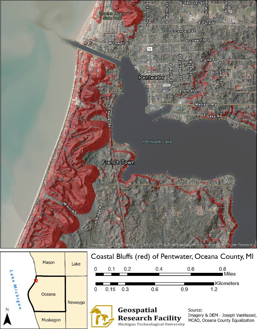
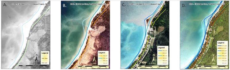
A main component of these land use planning methods is an understanding of the history of shoreline and coastal bluff change over time. This project uses Geographic Information Systems (GIS) to map historic aerial images from 2016, 2009, 1980 and 1938 and used those images to create historic shoreline and bluff line features that could be used to visualize historic coastlines and characterize areas vulnerable to future shoreline change.
Financial assistance for this project was provided, in part, by the Michigan Coastal Zone Management Program, Michigan Department of Environment, Great Lakes, and Energy, and is supported through a grant under the National Coastal Zone Management Act of 1972, as amended, administered by the Office for Coastal Management, National Oceanic and Atmospheric Administration.
![]()
![]()
![]()
Bluff Mapping in Oceana County, MI