")
A group of geospatial engineering students from Michigan Tech kicked off their 2025-26 year of classes with a working journey to Isle Royale National Park. The land surveying projects they completed will benefit the park's staff and visitors.
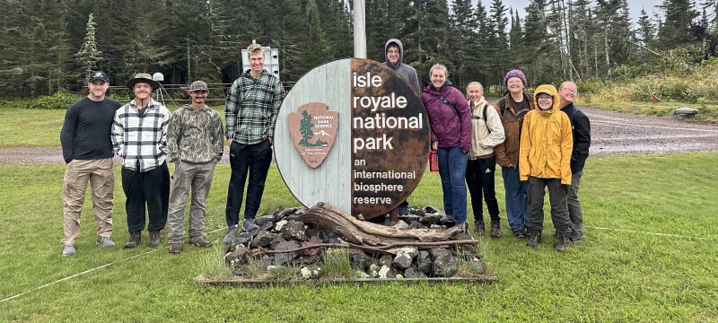
Not every university has a national park in its backyard. Just a six-hour boat ride from Michigan Technological University in Houghton, Michigan, Isle Royale National Park is a rugged, isolated archipelago in Lake Superior. Late this summer, when 10 geospatial engineering students at Michigan Tech wanted to put their surveying expertise to the test at the park over Labor Day weekend, it was as simple as asking.
"I just thought if I reached out to someone from Isle Royale National Park, they might have some work for us to do," said Ruth Kirby, junior geospatial engineering student. "Land surveying is one of those things that everyone needs done."
Kirby serves on the executive board of Michigan Tech's Douglass Houghton Student Chapter of the National Society of Professional Surveyors, known affectionately by its members as the surveying club. The organization provides geospatial engineering students an opportunity to gain experience through community service and surveying competitions.
At Tech, where practical, hands-on experience is vital to all undergraduate programs, surveying club members were looking to get more experience simply for the love of the game. Kirby and co-planner Ryan Keen contacted the park over the summer to see if there was a need for enthusiastic surveyors-in-training. Park officials quickly took them up on their offer.
"They had two projects they wanted us to tackle," said Kirby. "All I asked was when."
Into the Wilderness
On Friday, Aug. 29, the excited geospatial engineering students boarded the Ranger II in Houghton, bound for Mott Island, home of the park headquarters and the group's lodgings until the following Wednesday. This trip meant missing a few days of classes right at the beginning of the fall semester, but Tech's Department of Civil, Engineering, and Geospatial Engineering (CEGE) was supportive.
"Most of us were in upper-level geospatial classes and our professors wanted us to have that experience, so they told us to go have fun," said Kirby.
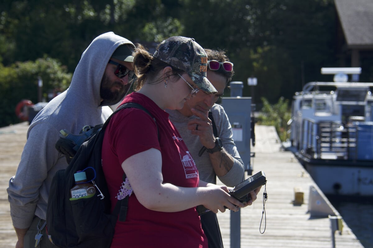
The national park gave the Huskies two assignments: Measure the water depth at as many of the docks as possible around the park's shoreline and locate electrical lines near Windigo Visitor Center and on Mott Island. Both projects were completed successfully, and will directly benefit both park staff and the public.
The students arrived at Isle Royale National Park with a plan and all the necessary equipment, generously provided to the CEGE department by Seiler Geospatial. The group's toolkit included a global navigation satellite systems (GNSS) receiver that utilizes a real-time kinematic positioning (RTK) system to accurately measure and record their assignments.
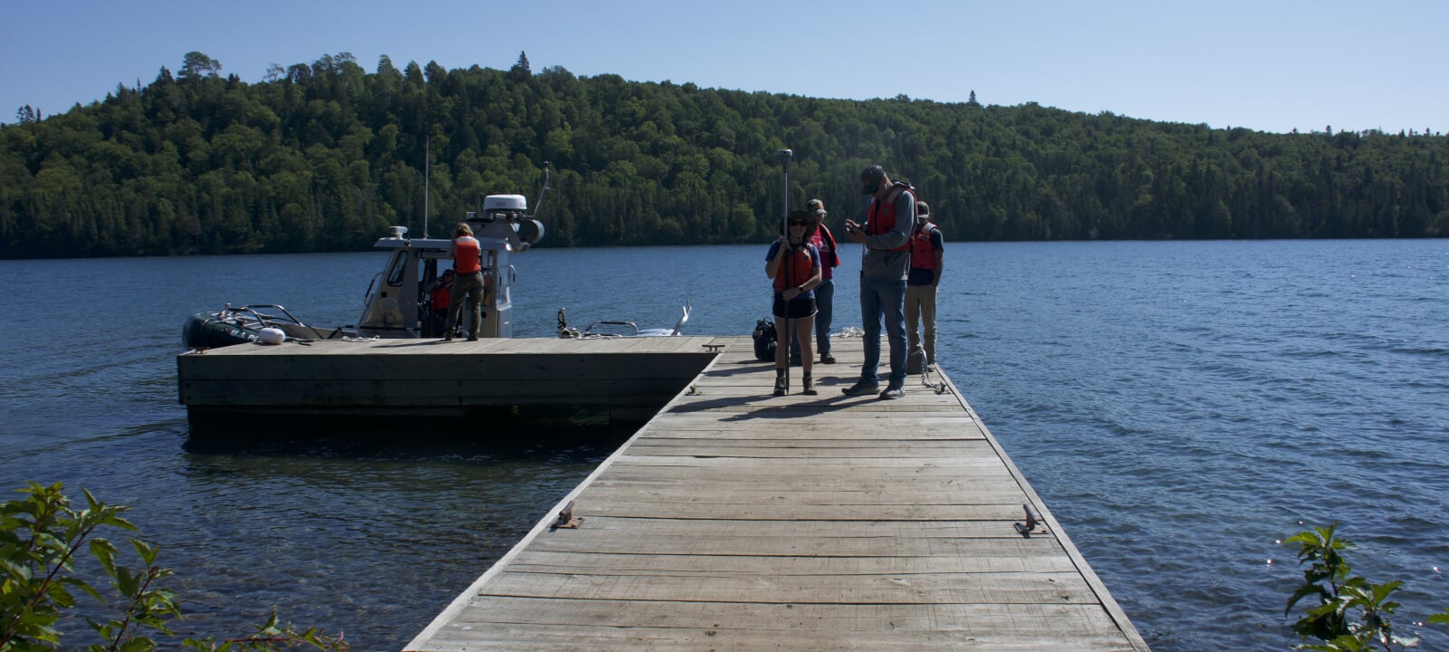
"A lot of people visit the park on yachts or sailboats," said Kirby. "Some of those island docks are really shallow and not all boats will be able to dock safely. Now the rangers will know more accurately what boats fit where."
Isle Royale is mostly an undisturbed, roadless wilderness, but it does have electricity near the main visitor centers and headquarters. Prior to the Huskies' visit, the underground electrical lines weren't mapped. In doing so, the students gave park administrators a more accurate understanding of which lines connect to which facilities and flagged locations where park staff should avoid digging.
Once the Huskies arrived, they got straight to work measuring depths at all the docks on Mott Island.
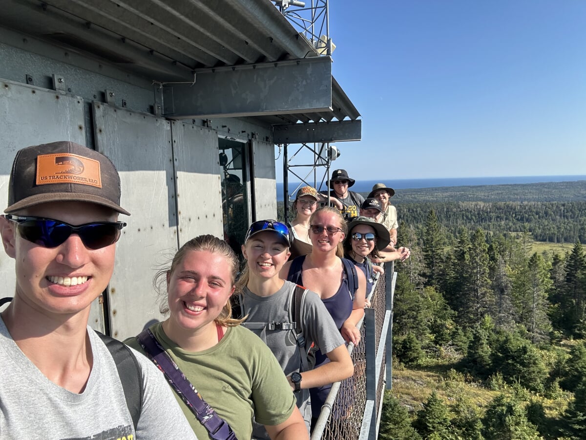
Over the next four days, the Michigan Tech students split into two groups, completing their tasks and exploring the freshwater archipelago. Guided by park rangers, the group knocked out more work than expected, measuring depths at close to 30 docks around the park and effectively mapping two sets of electrical lines.
"The rangers set aside more than enough time for us to complete our work, so we had a lot of extra downtime for hikes and swims," said Kirby. "They were really impressed by our work and speed."
The group gained critical experience in the field and got front row seats to all the beauty and wilderness that Isle Royale has to offer. In addition to their surveying work, they swam in Lake Superior, hiked Scoville Point and Mount Ojibway, watched seaplanes land and witnessed the northern lights.
Kirby's favorite part was the time she got to spend with her friends. "Everyone who went on the trip, we are all really good friends, so we had a really good time," she said. "These are some of my best friends and I know they'd say the same."
That's what makes the geospatial engineering program so special, Kirby said. "With my fellow students in school, in my projects, in our organization, it doesn't ever really feel like work," she said. "It feels like I'm just hanging out with my friends."
Everyone Needs a Geospatial Engineer
Kirby didn't initially attend Michigan Tech for its geospatial engineering program. Admitted as a statistics student, she had aspirations of becoming a teacher before realizing she was looking for something else.
"I found geospatial engineering and it had everything I love. I love sorting through data. I love drawing up maps. I love being outside. I loved how the labs are all really hands-on. It felt like a perfect mix."
Geospatial engineers understand the Earth. They study, measure and visualize the physical features of the planet in order to survey a piece of land's position, elevation, and boundary lines. At Tech, Kirby decided to pursue a BS in Geospatial Engineering after meeting with faculty members who explained their careers and the importance of geospatial engineering work.
"Everyone needs us," said Kirby. "We're first in the job and we're the last out. We map the preexisting ground before any project and then show how it's been changed after the fact. Everyone loves when surveying work gets done because then construction work can begin."
Most geospatial engineering students enjoy their work because of the time they get to spend outdoors, and Kirby is no exception. "In the more traditional sciences, people spend all day inside a lab," said Kirby. "Our lab is the outdoors and that's awesome."
However, what Kirby loves most is the artistic side of her studies.
"Like every little girl, I wanted to go to school to be an artist," said Kirby. "So, the thing that interests me most in geospatial engineering is CAD (computer-aided design) drafting. CAD drafting fulfills that dream. There's certainly more to it, but I feel like I'm drawing every day. I'm drawing a picture that benefits society."
While she may not have come to Tech with this career path in mind, Kirby's glad it's where she ended up. Michigan Tech's geospatial engineering bachelor's degree program is only one of two in the state and the only one in the Upper Peninsula.
"Because of our location, we just get to do some really cool projects," she said. "Instead of surveying highways and parking lots, we are scanning the Quincy Mine and surveying the Redridge Dam."
Currently, as part of an upper-level special topics geospatial engineering course, Kirby is assisting Mont Ripley with the necessary surveying work needed for additions to the main chalet and accessible parking.
"It's a small course, only four of us, so the professor is giving us a lot of freedom on how we want to plan this project and do the work," said Kirby. "It feels like we are our own small surveying crew."
All the practical experiences in her coursework and extracurricular activities have prepared Kirby for whatever her future has to offer. She plans to work the necessary four years before she can take the Michigan professional surveyor license exam, which she said is one of the harder surveying license exams in the country.
After earning her license, Kirby is still deciding which path she'll take. But in the short term, her plans are set. Michigan Tech's surveying club is working to expand its relationship with Isle Royale National Park for future geospatial engineering students.
"It's really great to be able to put our knowledge to work like this for the National Park Service," said Kirby. "And it's something we are going to keep doing! The rangers have more projects for us to do and the goal is two to three trips per year. This will continue to benefit the geospatial engineering program."
Michigan Technological University is an R1 public research university founded in 1885 in Houghton, and is home to nearly 7,500 students from more than 60 countries around the world. Consistently ranked among the best universities in the country for return on investment, Michigan's flagship technological university offers more than 185 undergraduate and graduate degree programs in science and technology, engineering, computing, forestry, business, health professions, humanities, mathematics, social sciences, and the arts. The rural campus is situated just miles from Lake Superior in Michigan's Upper Peninsula, offering year-round opportunities for outdoor adventure.


Comments