The Transportation Applications of Restricted Use Technology (TARUT) Study was a three-year effort to explore how satellite and other remote sensing data could address the needs of the Michigan Department of Transportation (MDOT). The study combined data from fine-detail, high-resolution remote sensing systems and other assets with advanced geospatial analysis techniques to examine transportation concerns. The data providers were civil agencies, commercial firms, and the US Department of Defense, as appropriate, to meet the study’s goals and objectives.
Objectives
Explore the applications of high-resolution remote sensing and advanced geospatial analysis to solve transportation problems.
- Phases I-III: 2005-2007: defining the problem, meeting with focus groups, demonstrating feasibility of methods.
- Phase IV: 2008 - 2009: Developing desktop GIS tools so MDOT can evaluate and validate TARUT Study methods, move toward implementation.
The four pilot studies are:
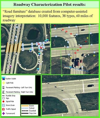
- Characterization of roadways and transportation corridors using remote sensing
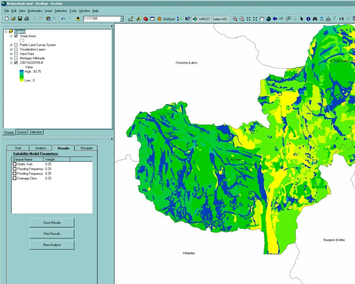
- Assessment of environmental context in transportation corridors and sensitive watersheds
- Analysis of traffic queues and delay
- Estimation of Annual Average Daily Traffic (AADT) with remote sensing
In Phase IV, two pilot studies were selected for creating demonstration GIS tools for MDOT: the Road Furniture tool and the Wetland Mitigation Site Suitability Tool (WMSST), both developed and tested by MDOT.