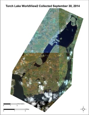
Satellite-based Mapping
Remote sensing, including aerial and satellite imagery as well as underwater acoustic imagery, are being analyzed to quantitatively and efficiently assess both the regional extent of EWM (identifying newly invaded areas at an early stage without intensive field monitoring based on the spectral characteristics of EWM) and the local outcomes of EWM treatments, enabling managers to monitor the impacts of and improve the techniques used for combating this invader and restoring natural habitat in important coastal areas of the Great Lakes.
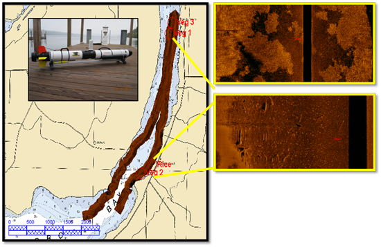
Sonar Surveying
Using ultra-high resolution EdgeTech Side Scan Sonar from the Michigan Technological University Great Lakes Research Center (GLRC), the aquatic vegetation in the study areas is being surveyed by boat.
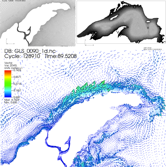
Hydrodynamic Modeling
Advanced next-generation, Great Lakes numerical, hydrodynamic modeling is underway at the (GLRC) at Michigan Tech, utilizing the new supercomputer, Superior. This is critical for our understanding of potential dispersal paths of EWM propagules and the water and nutrient conditions that foster EWM proliferation.