Earn Your Online Master's in GIS at Michigan Tech.
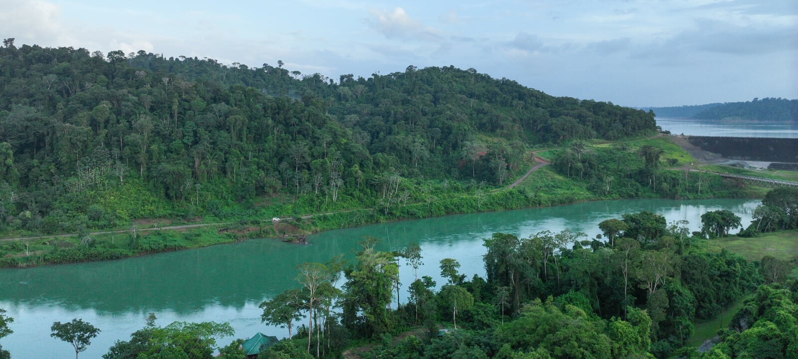
Geographic Information Science is often referred to as the scientific study of the principles and techniques underlying the use, development, and application of geographic information systems (GIS). It focuses on spatial data theories, analytical methods, and computational frameworks. Geoinformatics, alternatively, is an applied discipline combining GIS, remote sensing, cartography, and spatial data management. Its goal is solving real-world problems in various domains, such as in natural resources, urban planning, and environmental monitoring.
Overall, GI Science and Geoinformatics help us make smart decisions using data tied to locations, whether it’s for city planning, tracking climate change, managing disasters, or even finding the fastest route home. These disciplines have the ambitious goal, then, of understanding, analyzing, and modeling the spatial aspects of the world.
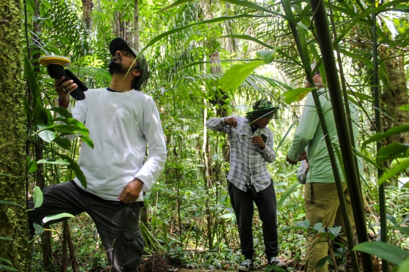
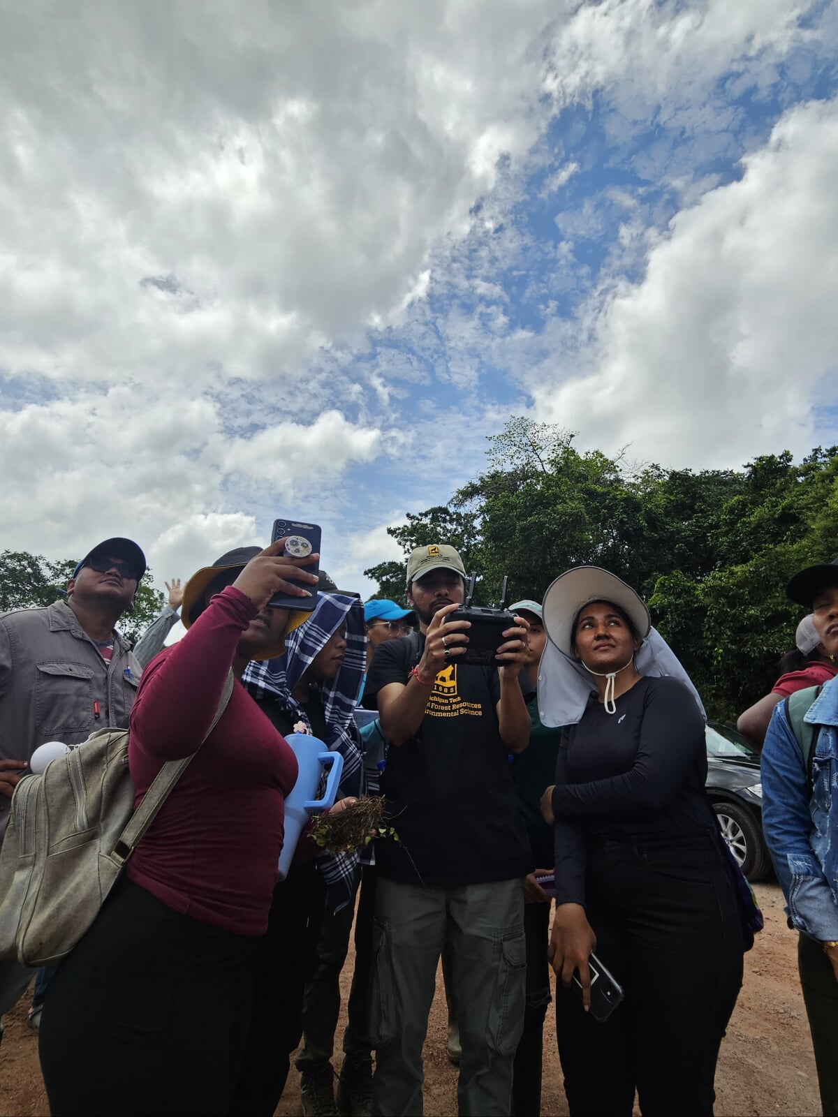
Michigan Tech's online master's degree in Geographic Information Science combines both theory and practical skills. When pursuing this degree, you will not only study the theories, principles, and methods underpinning the wide world of spatial data; but also apply GIS, remote sensing, and spatial analysis tools in real-world contexts. You'll learn to navigate and apply practical tools for natural resource management while diving into their efficient, responsible, and ethical use.
Build Your MS Degree From Three Online Certificates.
Michigan Tech's online master's degree in Geographic Information Science is built from three separate 9-credit certificates, which means you can earn in-demand credentials while pursuing your advanced degree.
You'll start with courses in the Foundations of GI Science, which will create a base of knowledge and skills for more advanced courses and certificates. Afterward, you will build on these foundational skills with advanced coursework in GI Science and Remote Sensing.
To dive deeper into this program, explore the pages for its three certificates.
- Foundations of GI Science for Natural Resources
- Advanced GI Science for Natural Resources
- Remote Sensing for Natural Resources
Why Learn About the Foundations in Geographic Information Science at Michigan Tech?
Earn A Versatile Degree.
This online program provides competencies and training that allow you to build on your experiences and expertise, whether it is in forestry, geosciences, social sciences, civil engineering, environmental engineering, and more. Get skills you can apply in your current job OR a for future career.
Get An Education From the Best.
Get instruction from Parth Bhatt who is not only a passionate instructor, but also an innovator with a breadth of real-world, international experience in GIS, Remote Sensing, GPS, Geospatial data analysis, machine learning, Python, R, ArcGIS Pro, WebGIS, and more.
Take Flexible, Online Classes.
Our asychronous courses are offered throughout the year, so you can steadily progress towards earning your master's degree. When planning your program, though, always remember to check what classes are offered each semester by consulting the course registration page.
Set Yourself Up for Diverse Career Opportunities.
A master's degree in Geographic Information Science (GIScience) for Natural Resources opens up a wide range of career opportunities at the intersection of spatial data analysis, environmental science, and natural resource management. There are several possible career paths, which depend on the organization in which you are employed.
For instance, if you were worked for the federal, state, provincial, or local governments, you might be a GIS Analyst/Technician mapping and analyzing natural resource data on vegetation, water bodies, or land use. Alternatively, as a natural resource specialist, you might use GI Science to monitor and manage forests, water, wildlife, and/or rangelands. And as an environmental protection analyst, you might wield spatial data to support regulatory compliance, manage habitat restoration, and monitor pollution.
These are just a few examples of possible careers. That is the theory, knowledge, and skills that you acquire in Michigan Tech's online MS in Geographic Information Science equip you for employment in government and public agencies and beyond.
Below is a sample of possible careers from various sectors.
Environmental and Conservation NGOs
- Conservation GIS Analyst
- Field GIS Coordinator
- Land Use Planner (Conservation Focus)
- Climate Adaptation Specialist (with GIS tools)
Technology, Data, and Mapping Companies
- GIS Solutions Engineer
- Spatial Data Product Manager
- Imagery Analyst (Natural Resources)
Private Sector and Consulting Firms
- Environmental GIS Consultant
- Remote Sensing Specialist
- GIS Developer/Data Engineer
- Hydrologic / Forest Modeler
Research, Academia, and Thinktanks
- Research Associate (GIS)
- Spatial Data Scientist (Natural Systems)
- GIS Lab Manager or Instructor
Plan Ahead By Consulting GI Science Job Boards.
Want to dive deeper into career and networking opportunities yourself? Below is a list of job boards, organizations, and resources for those with advanced expertise in Geographic Information Science.
When searching for employment, look for keywords such as GIS Analyst, Remote Sensing, Environmental Planner, Spatial Ecologist, Geospatial
Scientist, Natural Resource GIS.
Learn More About Dr. Parth Bhatt.

Parth Bhatt
- Assistant Teaching Professor/Researcher
- Program Director, MGIS Online Program
- GIS & Remote Sensing, MichiganView Member
- ppbhatt@mtu.edu
- 906-487-2291
- Noblet Building 189-190
Get Started On Your Online Master's (MS) in Geographic Information Science.
Take the next steps on your online educational journey at Michigan Tech. Fill out an RFI form so that we can answer your questions about your online program.