Project Overview
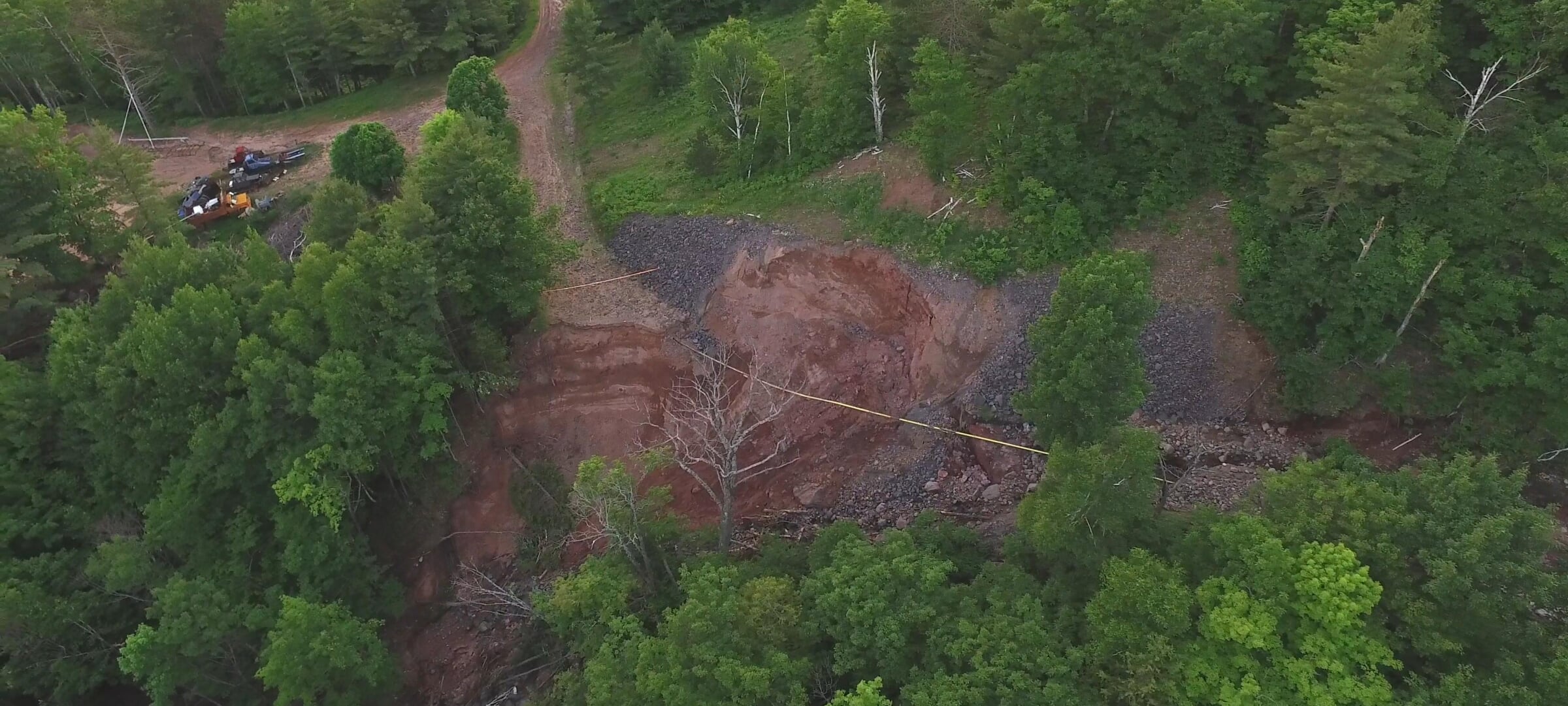
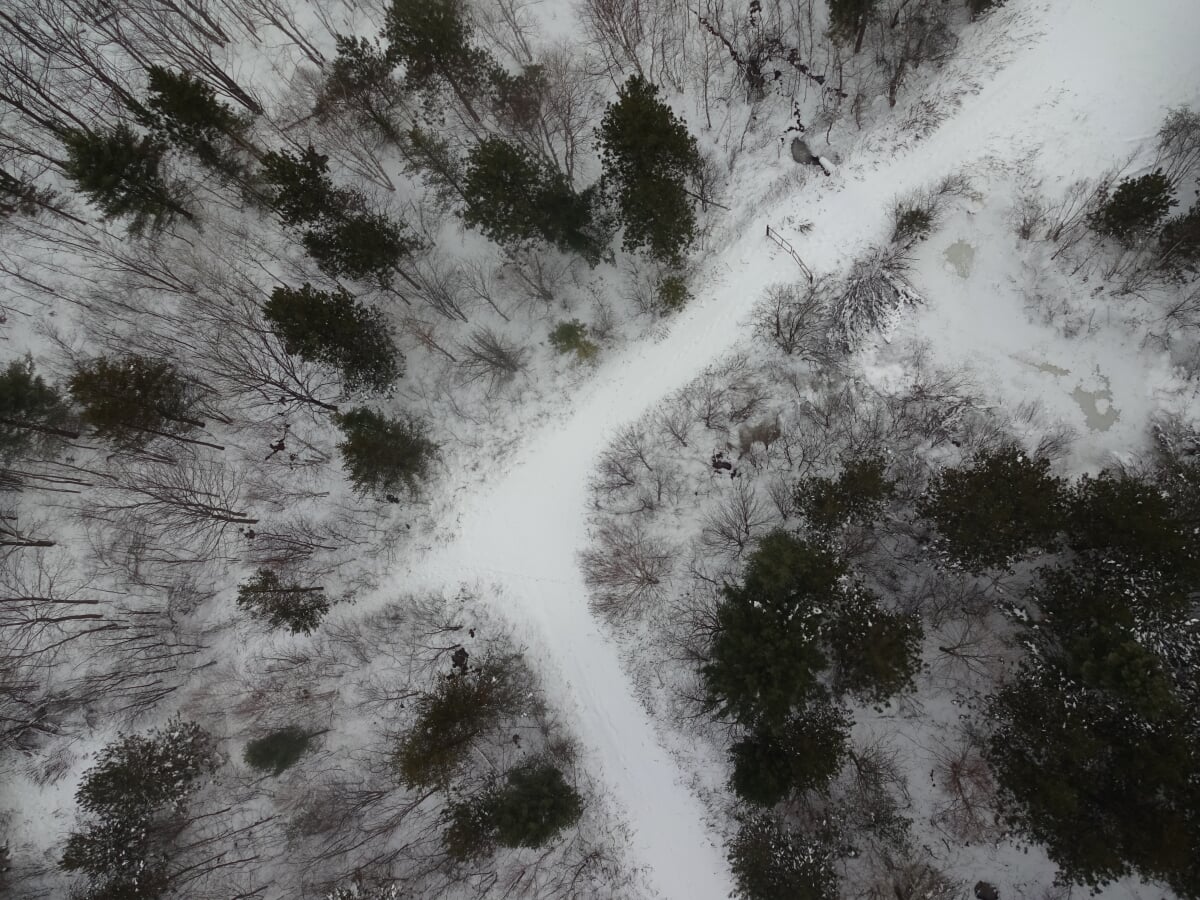
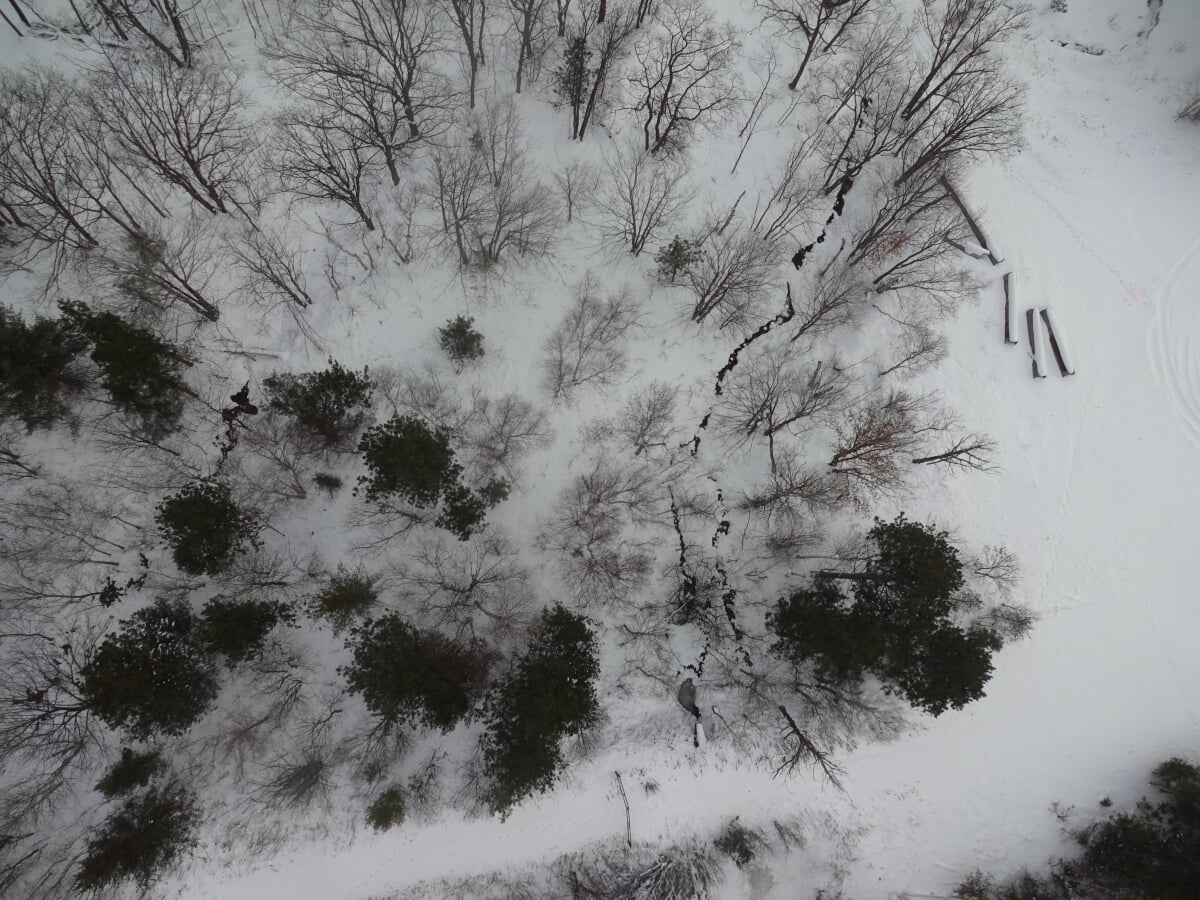
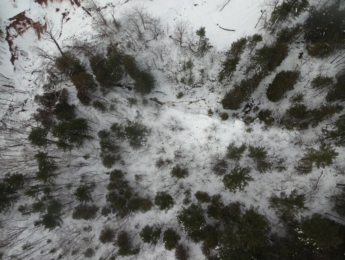
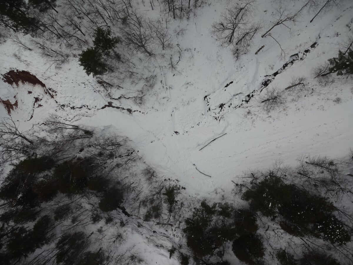
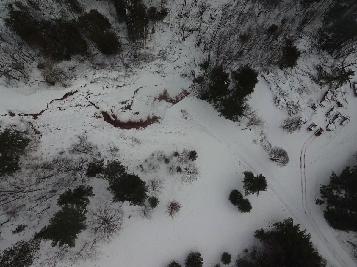
The intensity and amount of rain that occurred across Michigan’s Keweenaw Peninsula on June 17, 2018 led to a catastrophe locally known as the “Father’s Day Flood.” The flood waters and extreme runoff induced a number of landslides and extensive erosion of river and stream channels and roads. Two ski-runs on the eastern edge of the Mont Ripley Ski Hill in Ripley Township, Michigan failed as a result of high volumes of water moving across the steep terrain.
Five geological engineering students at Michigan Technological University are analyzing the stability of the failed ski slopes in order to design stabilization alternatives for facilitating future use as ski runs. The stability and hydrology analyses required topographic information that is being derived from aerial imagery, including fixed-wing drone surveys. Image processing is being used to improve the topographic maps for use in the slope stability and hydrological modeling.
Slope stability models also require the strength properties of the soils which were obtained from existing geotechnical reports of the area and site characterizations. Field measurements and observations were taken in the fall of 2018.
The results from the fall 2018 fieldwork and plans for the spring 2019 modeling and design were reported in December 2018.
Their fieldwork and topographic analysis suggest that the slope failures were probably the result of a combination of several potentially blocked/inadequate culverts, rapid discharge of large volumes of dammed water, and redispersion of water throughout the watershed. It is hypothesized that the railroad grade and plugged culvert resulted in a temporary earthen dam that failed catastrophically and released floodwaters and debris that eroded the downslope drainages and bottom parts of the slopes. The floodwaters and debris likely heightened the probability of slope failure and greatly impacted residential areas below the failure.
Approaches to stabilize the slopes and return them to conditions to allow their use as ski runs are currently being considered based on the results from the stability and hydrological analyses. The stability of the slopes is being modeled with a toe-erosion model to determine the effects of Ripley Creek on the failure surface and a three-dimensional slope stability model to determine the pre-flood soundness of the slope and volume of material moved. The hydrology of the creeks adjacent to the slopes is being modeled in order to evaluate the impacts of the floodwaters on the slopes and to assist future designs for managing runoff.
Final Project Report: Powderstash Run Failure: Analysis and Stability Report
Final Project Presentation: Mont Ripley Slope Failure
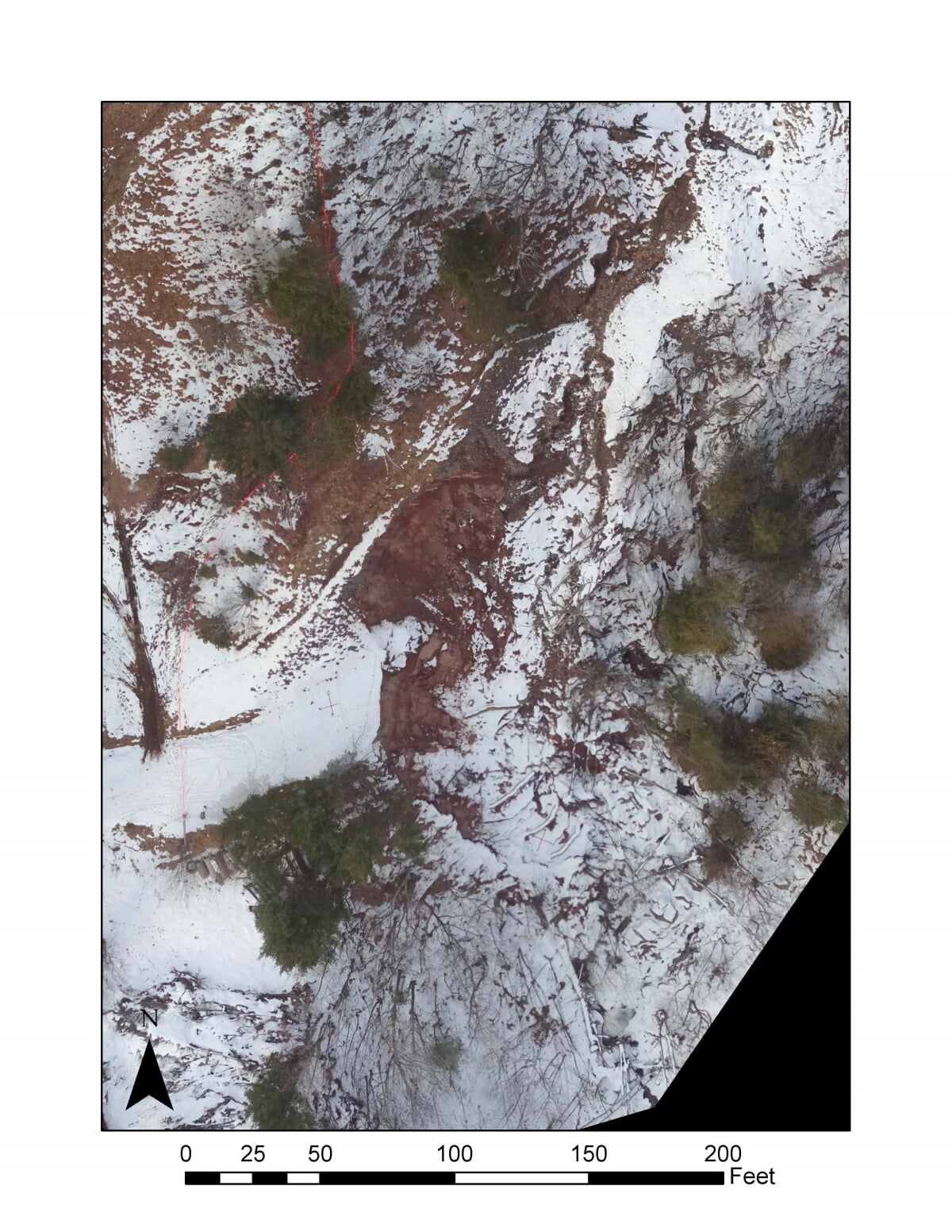
Drone Images - December 2018
About the Team
Undergraduate Geological Engineering Students:
Virginia Cistaro (vlcistar@mtu.edu)
Paige Courtney (pmcourtn@mtu.edu)
Allison Green (abgreen@mtu.edu)
Michelle Reaume (mmreaume@mtu.edu)
Maisy Snyder (mfsnyder@mtu.edu)
Advisors
Rudiger Escobar Wolf
John Gierke