A team of remote sensing experts, ecosystem modelers, wetland managers, and ecologists worked together to develop a strategic plan for control of the invasive plant Phragmites australis in the Saginaw Bay that would take into account nutrient loading, landscape position, pre- and post-treatment monitoring and site specific conditions for an adaptive management approach. Two grants provided various aspects of the project outputs.
MISGP Project Study Area
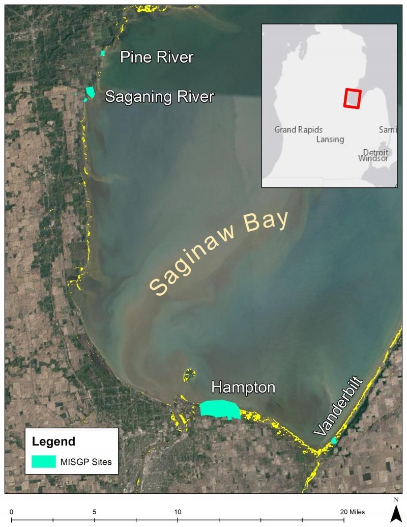
Link to the MISGP Project Study Area page
Outputs:
-
High resolution satellite maps of project sites
-
Estimates of N loading to each site
-
Site specific treatment scenarios from Mondrian
-
Mondrian Look-Up Table (LUT) management tool
-
Assessment of Drones for use in monitoring
-
Report on treatment effects on ecosystem recovery
EPA GLRI Grant Study Area
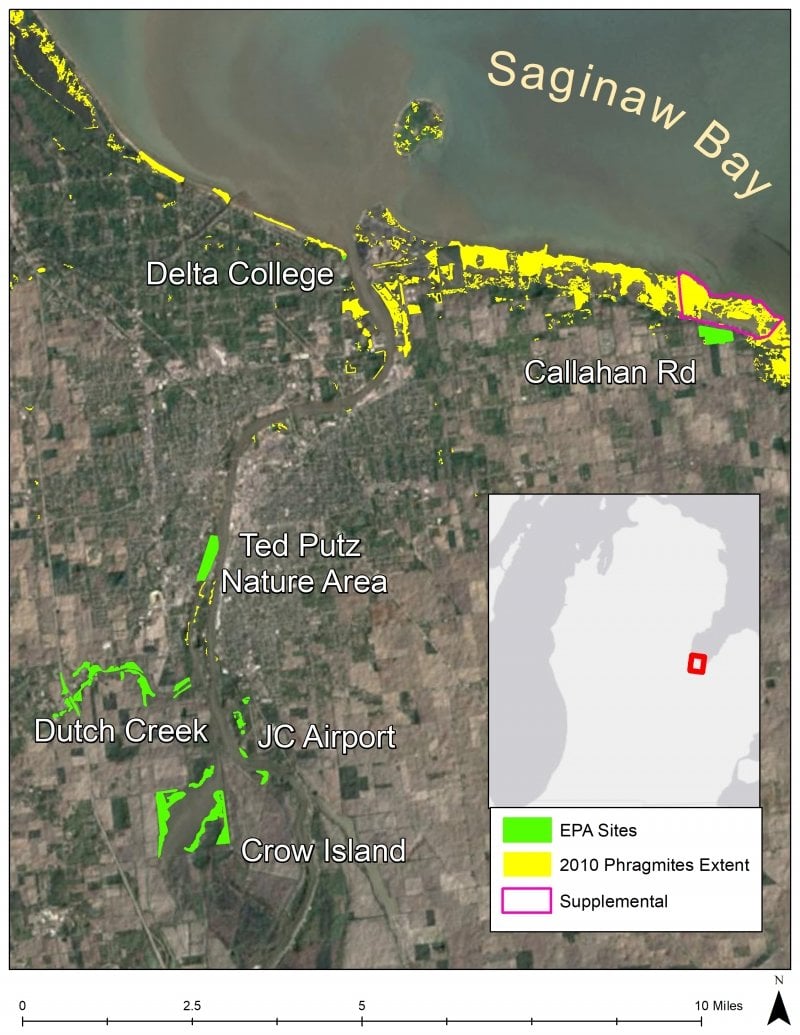
Link to the EPA GLRI Project Study Area page
Outputs:
- Project Report and appendices
-
Manager and Stakeholder Workshop Report
- Great Lakes Phragmites Collaborative Webinars
-
User Friendly Version of Mondrian Phragmites Management Tool and User Guide
-
Comparison of Mondrian to PAMF
-
Website with 2016 High resolution Maps of Phragmites Extent for the Coastal Zone of Saginaw Bay Watersheds
-
Website of Connectivity Modeling of Strategic Locations for Riparian Buffers for the Saginaw Bay Watersheds
-
Reporting and alert system for SB-CISMA and Mobilized EDR strike team for SB-CISMA
Combined Outputs from the MISGP and EPA GLRI Study Areas
- Strategic plan for control of Phragmites australis and ecosystem restoration in the Bay
- Great Lakes Phragmites Collaborative (GLPC) Webinar on Mondrian User friendly version and Quick Look-up Table
- Field and drone monitoring protocols and comparison of time/effort required for each
- Manuscript on Field Monitoring and Biodiversity analyses & Webinar on GLPC
- Training of SB-CISMA on field monitoring