Treatment Strategies
No one best policy for removal of Phragmites exists. When, where, and how to treat Phragmites needs to be assessed on a case by case basis. Factors to consider include size of the treatment area, biomass of the existing stand, water levels, propagule pressure, as well as, amount of N-loading to the system.
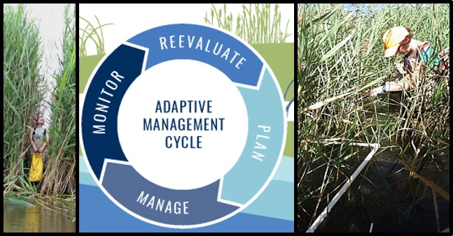
Novel Integrative Project
A novel invasive species project was focused on integrating modeling of N loading and hydrological connectivity with local and regional knowledge, monitoring (field and remote sensing) and best treatment strategies to create an adaptive plan for Phragmites control that targets specific treatment techniques and time intervals based upon conditions of the sites to be managed.
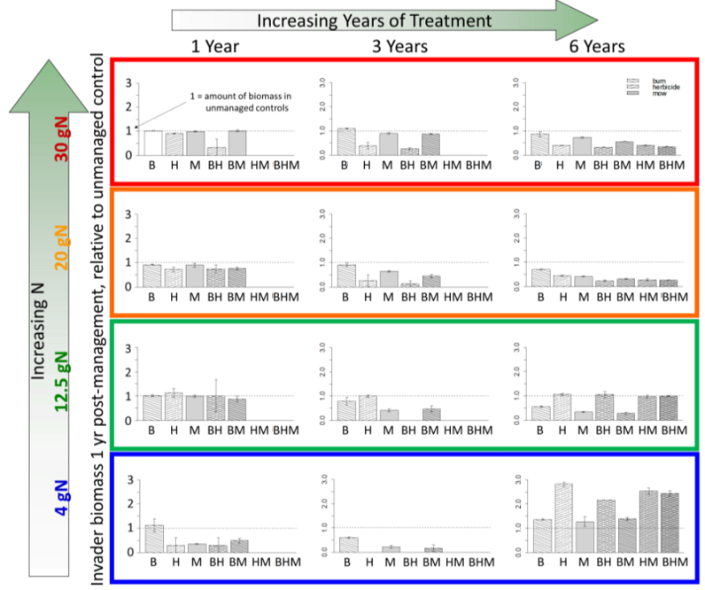
Modeling Treatments
Modeling of treatment effects in Mondrian has shown that treatment regimens (herbicide (H), burning (B), mowing (M)) have different effects depending on stand biomass and N-loading.
Monitoring
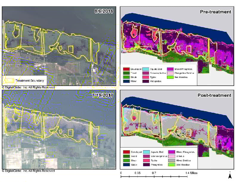
Monitoring is a key component of adaptive management. The project team used Worldview-2 satellite imagery to map pre- and post-treatment wetland types including live & dead Phragmites, Typha, and other wetland types. In addition the team has developed tiered field monitoring protocols to address a range of management needs.
Monitoring with Worldview-2 Satellite Imagery informs Management Decisions
Project Outputs
The project resulted in a webinar training on Mondrian for managers, a decision support tool in the form of a look-up table of site conditions to determine optimal suggested treatment regimen including timing and treatment method (herbicide, burning, mowing), and a series of monitoring protocols for various application needs.
View the Final Report and Appendices.
- Appendix 1 - Compilation of Treatment Protocols
- Appendix 2 - Compilation of Monitoring Protocols
- Appendix 3 - Tying monitoring to Management Goals
- Appendix 4 - Strategic Plan
- Appendix 5 - Historical Imagery to Determine Preinvasion Landcover
Reducing the Source of Invasion
The project also included modeling of hydrological connectivity to determine strategic locations for building riparian buffers to reduce N-loading to the coastal wetlands for all of Saginaw Bay. A web-interface was created to view the maps under funding from the EPA grant.