Historic changes in land use and cover along the coasts of the Great Lakes have influenced the spread of invasive species into wetland ecosystems. The goal of this project is to utilize past efforts at quantifying these influences and extend the results both spatially and temporally across the Great Lakes Basin. We will couple agricultural, ecological, hydrological processed-based models in conjunction with remotely sensed data to observe how changes in land use have affected the spread of invasive species and make estimates of future changes.
Mapping Three Decades of Land Cover Change
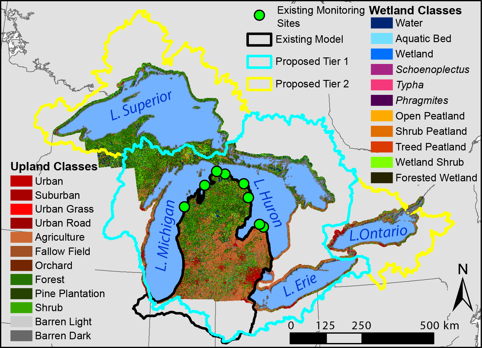
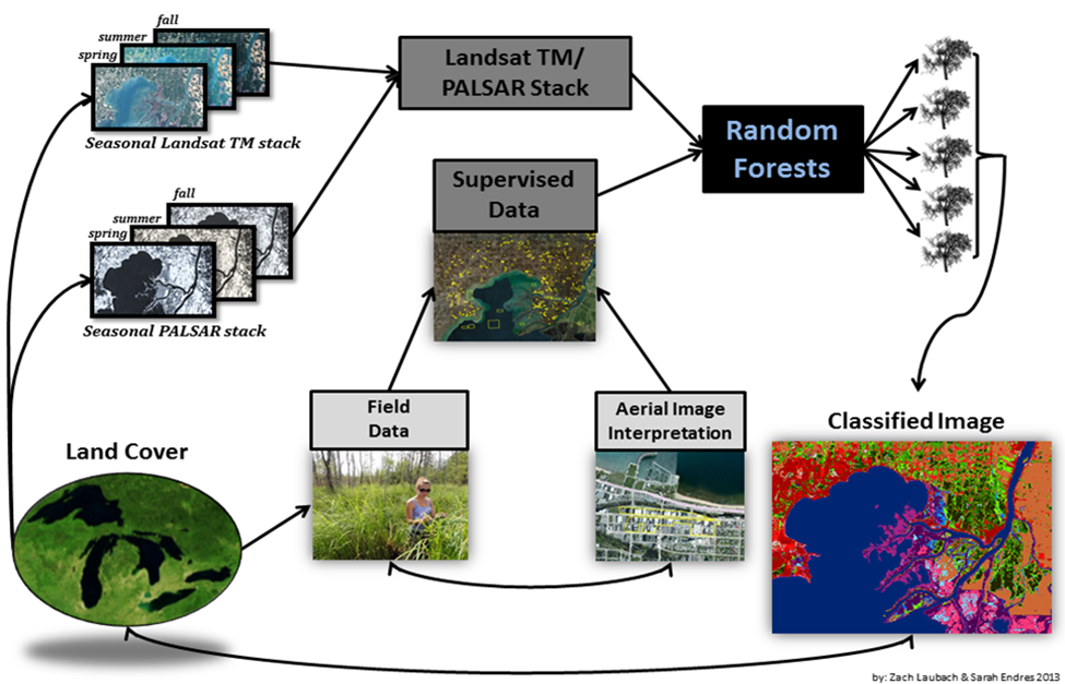
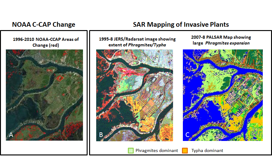
An existing 2010 land cover map (Figure 1) will be expanded to include the full Great Lakes Basin (tier 2) using a radar-optical imagery fusion in a machine learning classifier (Figure 2). This map will serve as a base to track and quantify land cover changes that occurred over the previous three decades (1980 – 2010) using a hybrid of categorical and spectral information to highlight changes between time-series imagery (Figure 3).
Coupling Process-Based Models to Quantify Human and Environmental Effects on Coastal Ecosystems
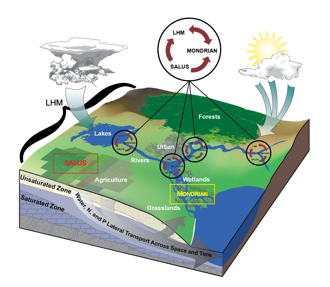
Three process-based models will be used to simulate changes in agricultural land use, native and invasive vegetation communities, and water flow across the Great Lakes Basin (Figure 4). Running these models simultaneous will allow us to better estimate how different human and environmental variables, such as agricultural runoff and lake levels, affects the spread of invasive species. Model results will be validated using the time-series land cover datasets.
Preparing for the Future
Calibrated models will be used to predict future changes in invasive species extent through 2050. A meeting will be held between stakeholders and researchers to develop tools and management strategies to help combat and mitigate the effects of invasive species in coastal ecosystems.