Equip Yourself With Fundamental GIS Skills.
Geographic Information Science (GI Science) studies how we collect, analyze, and interpret information about places on Earth. It draws on geography, computer science, and statistics to work with maps, satellite imagery, GPS, and other location-based data—helping us understand where something is happening, why it’s happening there, and how places are connected.
For example, a city planner choosing a hospital site might combine population data with road networks, traffic patterns, and emergency-call locations, then use GIS models to test which locations improve access and response times. In natural resource management, GI Science supports tasks like forest inventories by integrating remote sensing (satellite imagery or LiDAR), GPS, and field surveys to map forest composition, structure, and health, such as species, age, canopy cover, and distribution, all by using GIS software.
Intrigued by the possibilities of GIS? Michigan Tech offers a practical, 9-credit graduate certificate that builds foundational GIS skills for natural resources. You can complete the certificate on its own or stack it with others toward a master’s degree in GIS.
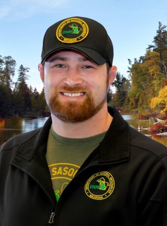
Learn About GIS in the Real World: Read James Miller's Story.
Meet James Miller, a wildlife habitat biologist with the Michigan DNR, who strengthened his GIS skills through Michigan Tech’s Foundations in Geographic Information Science for Natural Resources certificate.
In this student spotlight, James shares what it was like balancing an online program with full-time work, how the coursework translated directly into better mapping and analysis on the job, and why he’s continuing on to the Advanced GIS certificate. He also talks about how he’s applied new tools and workflows to support field work and decision-making. He turned GIS from “something I’ve always been interested in” into a skill set his team can rely on.
If you’re curious what GIS training can look like in the real world—and what it can unlock professionally—his story is worth the read.
What GIS Courses Will You Take?
This compact online GIS certificate is flexible enough to fit around the demands of your life, your job, and your other responsibilities. All students will take the same three foundational courses.
Required Courses
What Have Some Former Students Said?
"I have been able to implement all of the skills you have been teaching into my daily work to be more efficient, accurate and overall better at my GIS work. Those around me are impressed with the new tools I have been able to bring to the table, the efficiency I have gained, and the end result products that I am putting out. My office's GIS program for DBM, analysis and presentations have been complemented greatly over the past few months.."
" I very much enjoyed the course. You were prompt to respond to emails and very open to meeting with students when they wanted to. My personal life is very busy as I work full-time for the Michigan DNR, have a working spouse, a toddler and our 2nd little one on the way. Coming back to school while having a family to care for was a difficult challenge but your methods and efforts made me feel confident in being able to complete this class successfully. For my learning style and capability I would not change anything in this course."
Who Uses Geographical Information Science?
In general, GI Science is a versatile skill set, used by global professionals in a number of workplaces, such as the following: natural resource management, government agencies, environmental and conservation organizations, urban and regional planning, real estate and property management, insurance industry, and the energy sector.
And, as the field continues to evolve, professionals with GIS experience will likely find additional opportunities in emerging areas and industries that leverage location-based data for decision-making and innovation.
Whether working in your community, in the US, or abroad, the Online Certificate in Geographic Information Science in Natural Resources will prepare you for several career paths.

Possible GIS Jobs
- Conservation Scientist
- Environmental Consultant/Planner
- Forester
- GIS Analyst/Technician
- GIS Project Manager
- Natural Resource Manager
- Wildlife Biologist
- Remote Sensing Specialist
Dive Deeper Into This Online GIS Program.
Want to learn more about this certificate and the others that make up Michigan Tech's Online GIS Program? Then watch the recording below. This video is 39 minutes long, so if you're pressed for time, use the key below to go to the section that contains the information you need.
- Introductions: 0-5:44
- Why Study GIS at MTU? + Dr. Parth Bhatt's Credentials: 5:44 -11:50
- Online GIS Program: (Overview): 11:51 - 20:19
- A Peak Inside the Program: 20:20 - 29:14
- Important Next Steps (Application, the Admissions Process, Contacts): 29:15 - 32:28
- Questions: 32:29 - 38:57

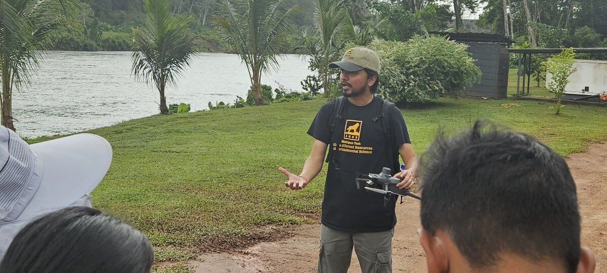
Learn More About Dr. Parth Bhatt.
Get instruction from Parth Bhatt who is not only a passionate instructor, but also an innovator with a breadth of real-world, international experience in GIS, Remote Sensing, GPS, Geospatial data analysis, machine learning, Python, R, ArcGIS Pro, WebGIS, and more.

Parth Bhatt
- Associate Teaching Professor/Researcher
- Program Director, Online Master's of GIS
- Lead GIS & Remote Sensing Educator, MichiganView
- ppbhatt@mtu.edu
- 906-487-2291
- Noblet Building 189-190
Get Started On Your Online GIS Certificate.
Take the next steps on your online educational journey at Michigan Tech.
Reach out to our kind, dedicated admissions manager, Amanda Irwin. She has a decade of experience helping students evaluate programs, navigate the admissions process, and complete their applications. Email her at globalcampus@mtu.edu or submit the RFI form below.