Earn Your Graduate Certificate at One of the Top Colleges for Geospatial Science and Mapping in the Nation.
1887: That was the year the word “photogrammetry” was first used by Prussian architect Albrecht Meydenbauer, who produced some of the earliest topographic maps and elevation images. From these roots, photogrammetry has grown into the process, science, and technology of interpreting photographs and two-dimensional images.
Simply put, a photogrammetrist is a specialized mapmaker with the advanced technological skills needed to create models of Earth’s surface. Much like cartographers, they create maps for online and mobile use. They conduct large- and small-scale surveys to create highly sophisticated maps used in regional and urban planning.
When you join MTU’s advanced photogrammetry program, you'll master the photogrammetry process and the technology used by professionals in the field every day to prepare for a diverse range of career fields. Alternatively, you might use this certificate to lay the foundation for a master’s program.
Take Specialized, Job-Ready Classes.
In-demand photogrammetrists require the specialized training and knowledge from a highly ranked program. AT MTU, we’ve designed a graduate certificate program to make sure that you’re well-prepared to pass exams for UAS certification and mapping certification so that you can find your ideal job sooner.
Every student in the advanced photogrammetry certificate program will take two required courses and then choose one elective from a choice of four courses.
When planning your program, make sure you check the course registration page for the availability of classes.
Required Courses
Electives (Choose One)
This certificate is also available as an on-campus option.
Why Earn Your Advanced Photogrammetry Graduate Certificate at MTU?
When you attend Michigan Tech University, you’ll receive guidance from experts in their fields in preparation for earning your mapping certification and UAS certification. This expertise will help you stand out from other job candidates. Employers around Michigan and the nation recognize MTU graduates for their work ethic and dedication to the photogrammetry process as it relates to different industries.
Furthermore, according to a 2024 analysis from The Wall Street Journal and College Pulse, MTU is ranked as the No.12 best colleges and universities for salaries. But there are other reasons for getting your online photogrammetry certificate from Michigan Tech.
Practical Industry Experience
To help you grasp the nuances of the photogrammetry process, your photogrammetry and mapping classes will teach you how to apply theories to the real world, including how to write your own computer code to implement photogrammetric processes.
Professional Preparation
Join a photogrammetry program that boasts 100% job placement rate for graduates — thanks to specialized training in preparation for exams required for mapping certification and UAS certification.
Experienced Faculty
With small classes, you’ll benefit from individualized attention from faculty mentors who put their students first. Work closely with specialists in photogrammetry and agriculture, aerial photography, and automated camera collaboration.
What Can You Do With a Graduate Certificate in the Photogrammetry Process?
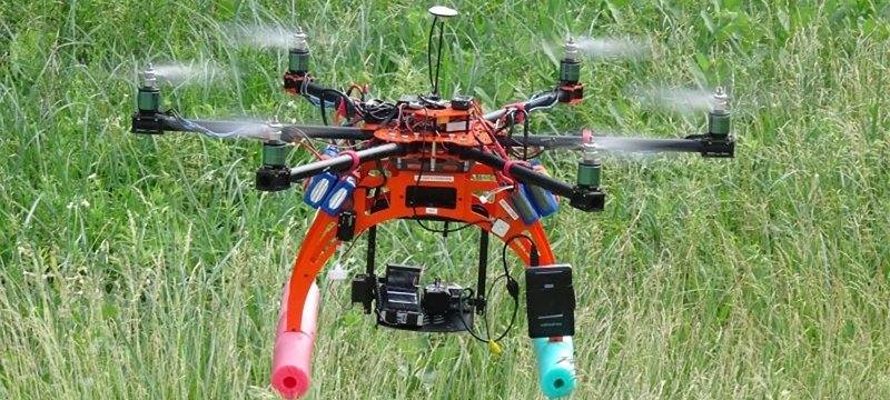
In today’s world, the photogrammetry process (or mapping) is more important than ever. Architects and engineers — as well as federal, state, and local government agencies — depend on advanced photogrammetry to work safely and efficiently.
Earning a graduate certificate in advanced photogrammetry with mapping unmanned aerial systems (UAS) from Michigan Tech will prepare you for both UAS certification and mapping certification exams — laying the groundwork for an impactful and rewarding career in several modern workplaces.
Those with photogrammetry expertise often work as surveyors, mappers, technicians, and designers.
Possible Career Paths
- Architecture
- Cultural Heritage
- Engineering
- Geology
- Government
- Manufacturing
- Police Investigation
- Topographic Mapping

Get Started on Your Advanced Photogrammetry Certificate.
Take the next step on your educational journey at Michigan Tech. We are here to answer your questions and to help you succeed in your online program.