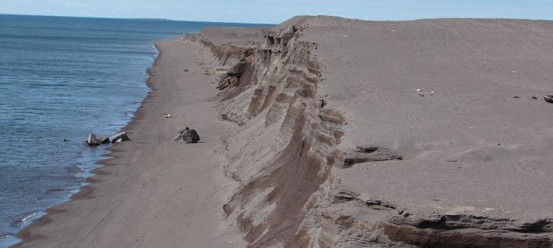
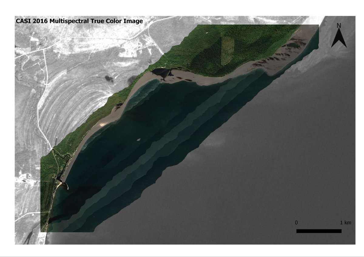
In Gay, Michigan, a large metal-rich 'halo' exists in sediments around the Keweenaw Peninsula, a consequence of past copper mining. Waste rock from coastal tailings has migrated along extensive stretches of shoreline, threatening critical fish breeding grounds and coastal benthic invertebrate communities, damming stream outlets, and intercepting wetlands and recreational beaches. In Grand (Big) Traverse Bay, Buffalo Reef is a productive spawning area for lake trout and whitefish essential for commercial enterprises and recreational fishing.
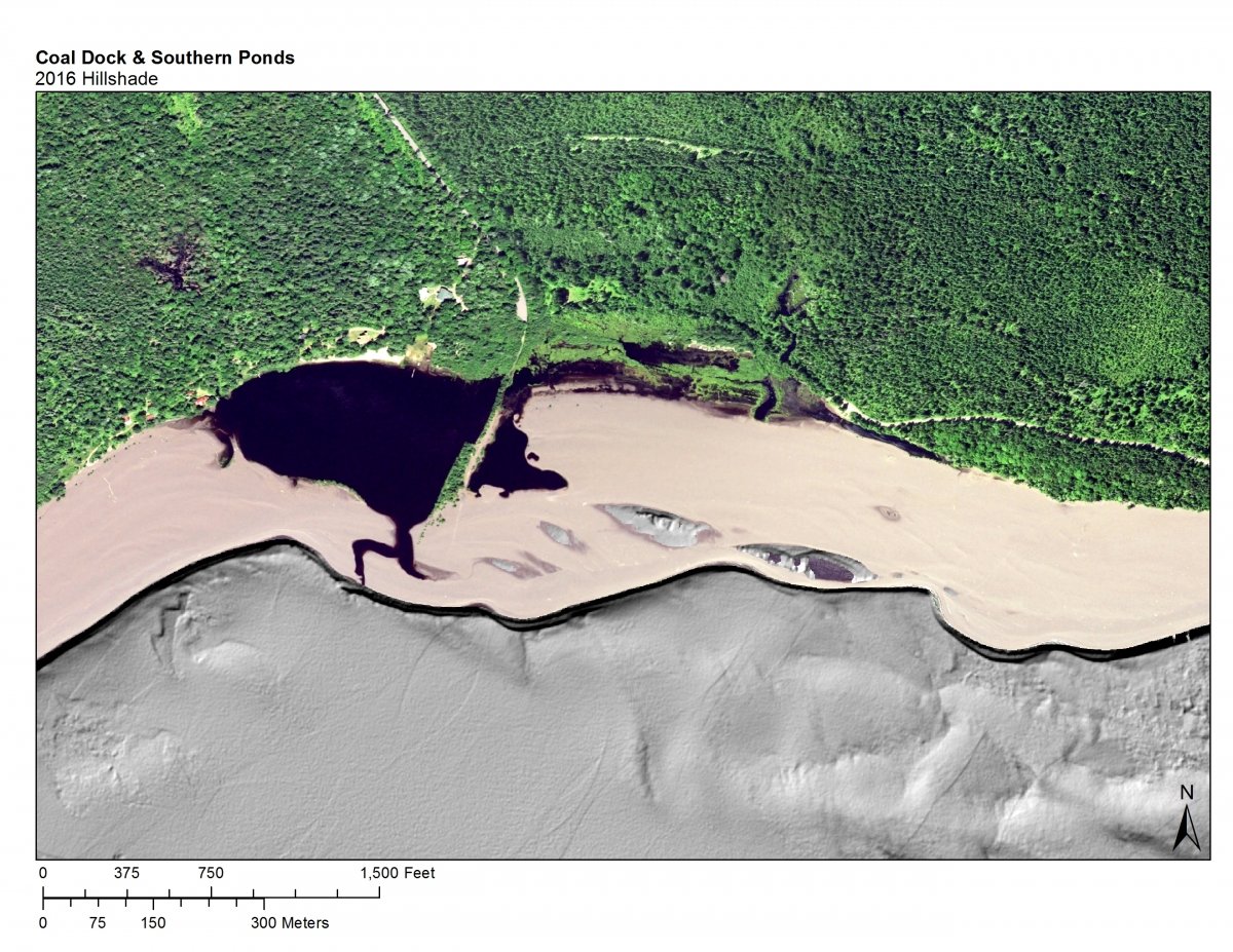
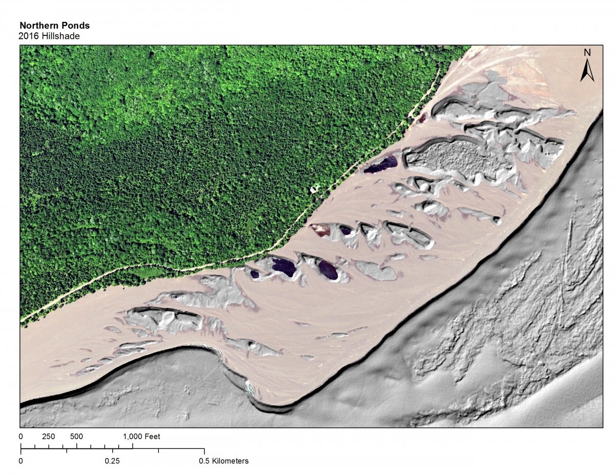
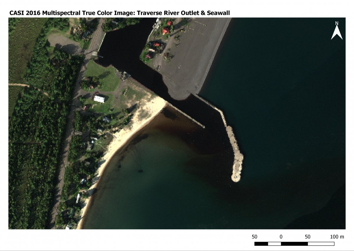
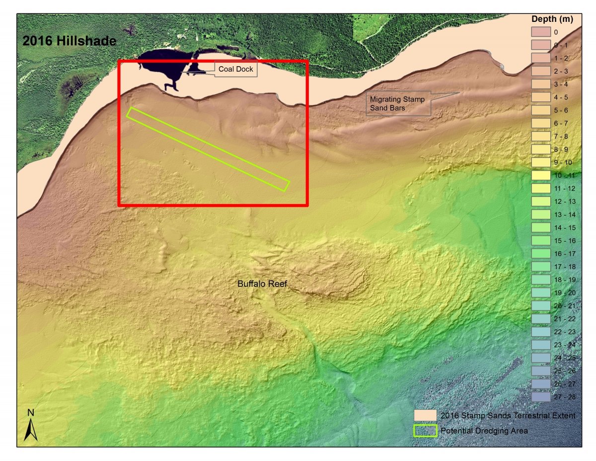
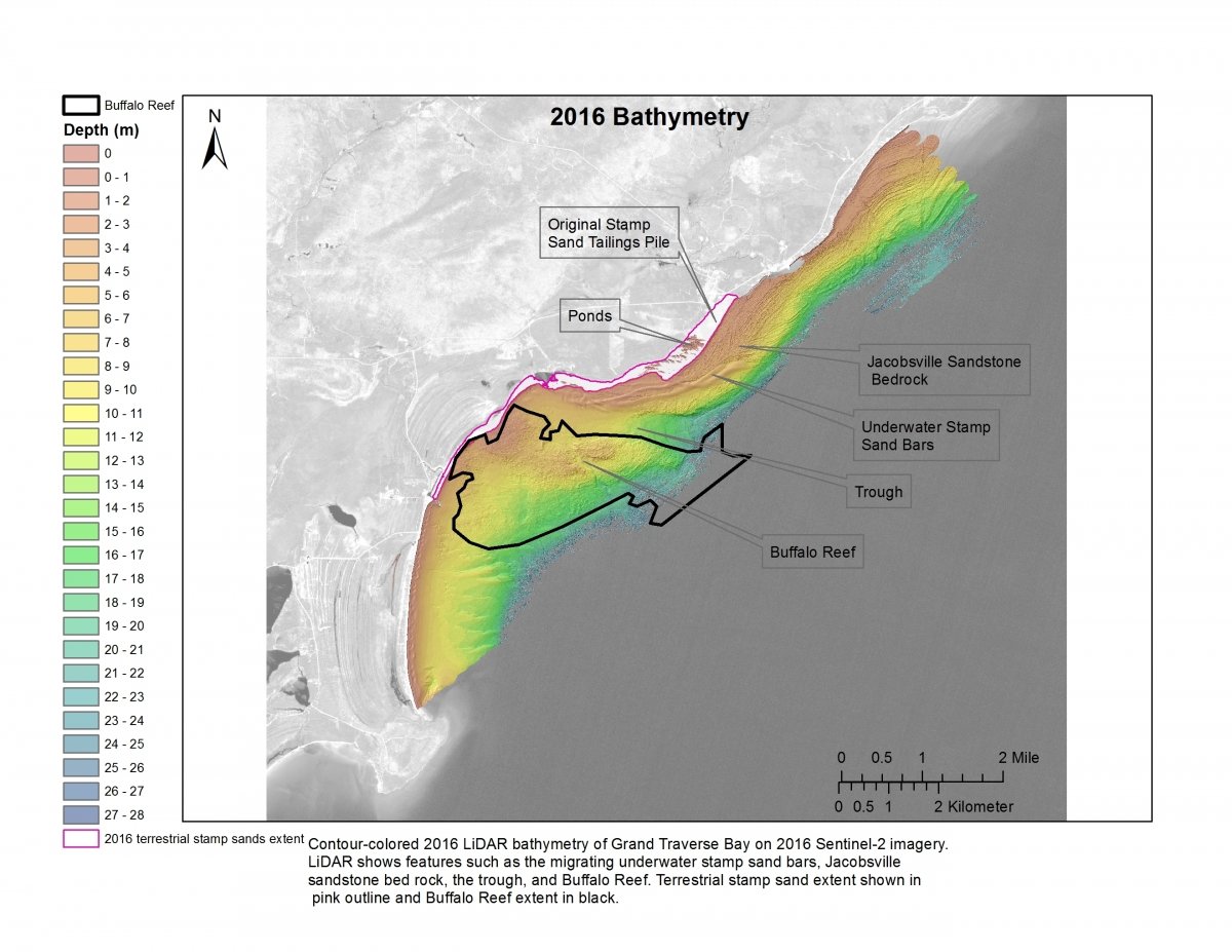
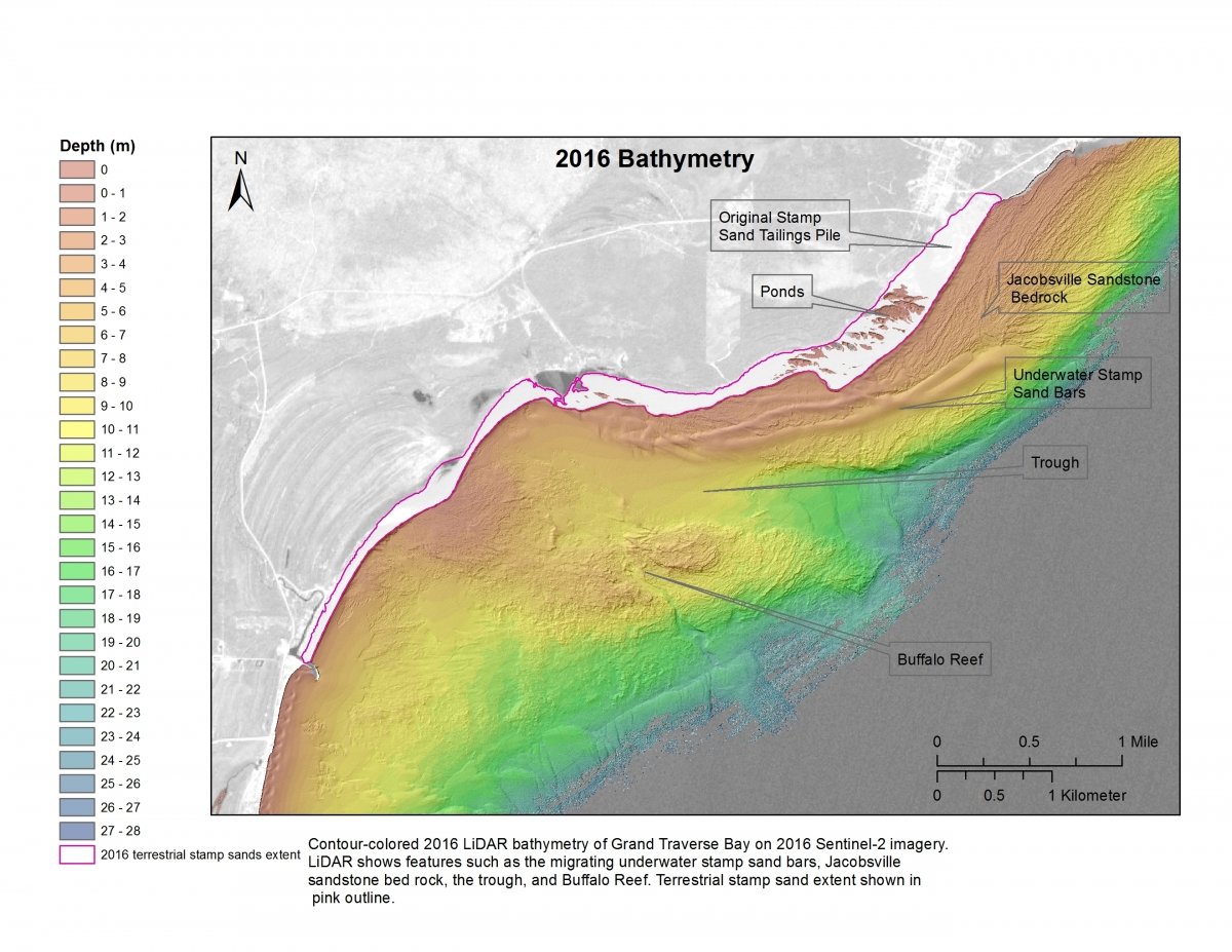
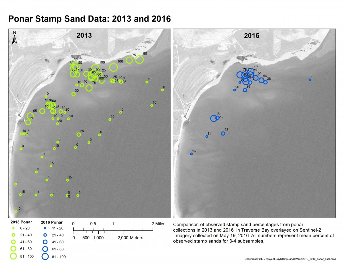
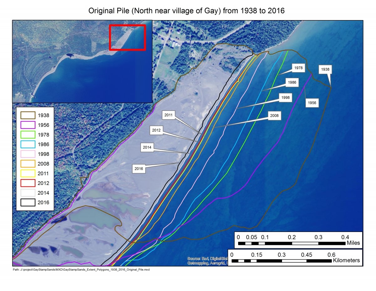
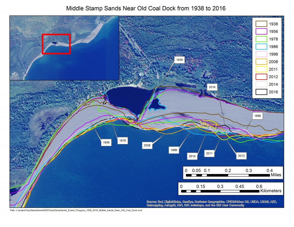
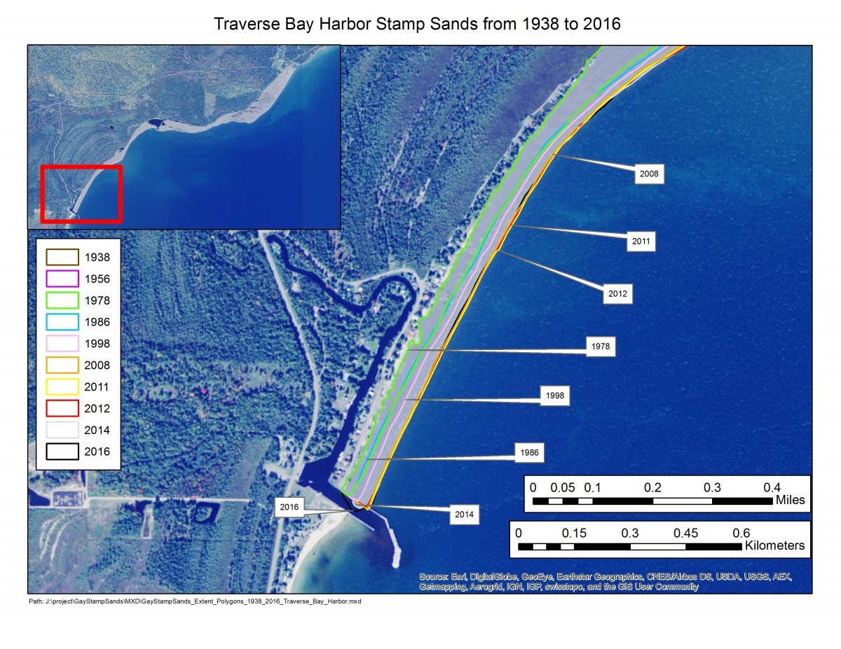
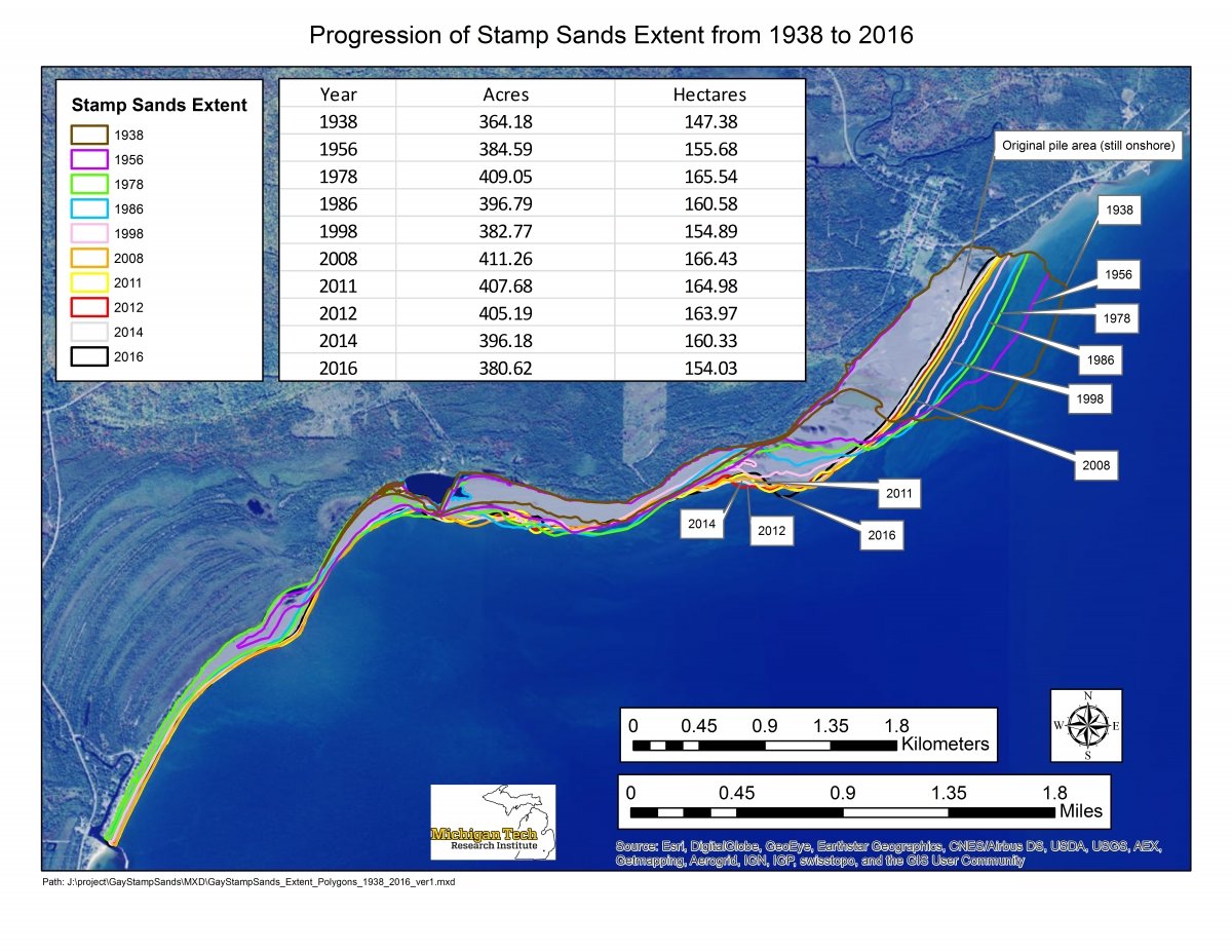
Using a combination of LiDAR and imagery, a team from Michigan Tech University is working with the US Army Corps of Engineers, the US EPA, the Michigan DEQ, and others on updating analyses on stamp sand encroachment prior to dredging activities in the "trough" region, in conjunction with ground-truth Ponar and ROV studies that will help determine percent stamp sand and toxicity in covered regions.
Visit the Gay Stamp Sands mapping website to explore geospatial data products developed under this project. https://spatial.mtri.org/stampsands/

Information about Buffalo Reef from the Great Lakes Indian Fish & Wildlife Commission (GLIFWC)
Saving Buffalo Reef
![]()
![]()