Dangerous nearshore currents (DNCs), including rip, channel, structural, and outlet currents, are common in the Great Lakes and can be extremely dangerous to swimmers. Michigan has the fourth deadliest coastline in the US in terms of annual drowning deaths, led only by Florida, California, and North Carolina. From 2002 to 2014, the Great Lakes Basin experienced an average of 11 rip current fatalities per year.
The Great Lakes Basin encompasses more than17,500 km (almost 11,000 miles) of coastline and at almost 2,000 km (1,250 miles), more than the US Atlantic and Pacific coasts combined, much of which is accessible to tourists. Given this vast extent of coastline and the corresponding large number of visitors and residents, dangerous nearshore currents in the Great Lakes are a phenomenon that should not be overlooked. Despite the number of nearshore-current-related deaths in the Great Lakes, there has been little national recognition of the importance of this phenomenon in Great Lakes states. Improved prediction, mapping, and modeling of DNCs is critical to saving lives. Additionally, monitoring and sustaining beach safety is critical to many local coastline economies dependent on tourism and local beach users.
Assessing Hazards at Michigan State Park Beaches (2012-2015)
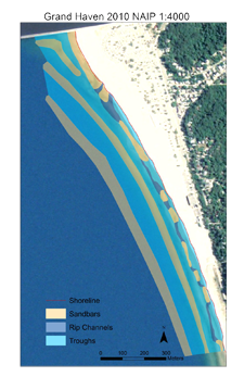
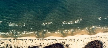
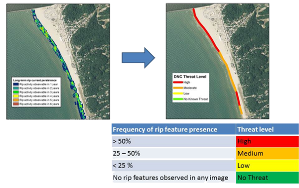
For each Michigan State Park located on a Great Lake, a DNC Hazard Map was created based on an analysis of high-resolution aerial and satellite imagery compiled from several sources. Imagery was included in the analysis if it was cloud-free, oriented in such a way that the lake bottom was not obscured by water surface glint, and suspended sediment was not occluding the water column. Using the ArcGIS environment, shorelines, longshore sandbars and channels in the bars were manually delineated. The shoreline of each park beach was divided into 100-m sections, and every section was assigned a threat level based on the proportion of all usable images for that stretch of shoreline that contained observable bathymetric features associated with DNCs. The results of this effort are shared in the form of this dangerous near shore current web map to support public safety outreach efforts to educate Michigan beach users about this common coastal natural hazard.
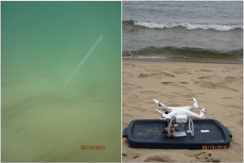
The results of image interpretation were validated using bathymetric lidar and by collecting perishable data on the locations of rip channels and currents following strong wind events. This project has generated novel information on the distribution and frequency of rip currents and their persistence over time. Long term, these types of data will improve rip current prediction and forecasting and therefore public safety.
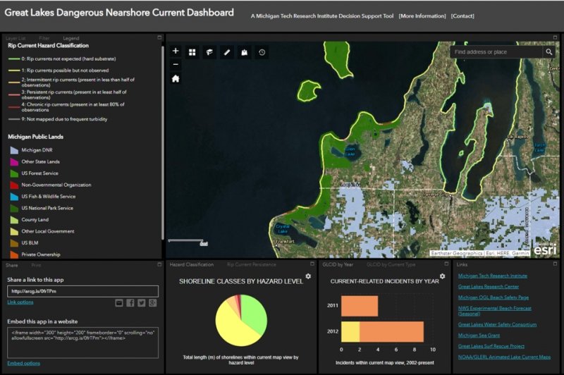
Mapping and Creation of a Geospatial Decision Support Tool for Great Lakes Beach Hazards (2018)
The latest phase of this research program has involved expanding the hazard-level mapping to all Michigan shorelines along Lakes Michigan and Superior, as well as collecting additional perishable field data on rip currents in both lakes as case studies to better understand how a current develops and decays over the course of a strong wind event. This shoreline-wide map product, together with several other geospatial datasets and nowcasts, can be viewed on the Great Lakes Dangerous Nearshore Current Dashboard.
Financial Assistance
Financial assistance for this project was provided, in part, by the Michigan Coastal Zone Management Program, Office of the Great Lakes, Department of Natural Resources under the National Coastal Zone Management Program, through a grant from the National Oceanic and Atmospheric Administration, US Department of Commerce. The statements presented on this website are those of the grantee, Michigan Technological University, and do not necessarily reflect the views of the Department of Environmental Quality and the National Oceanic and Atmospheric Administration.