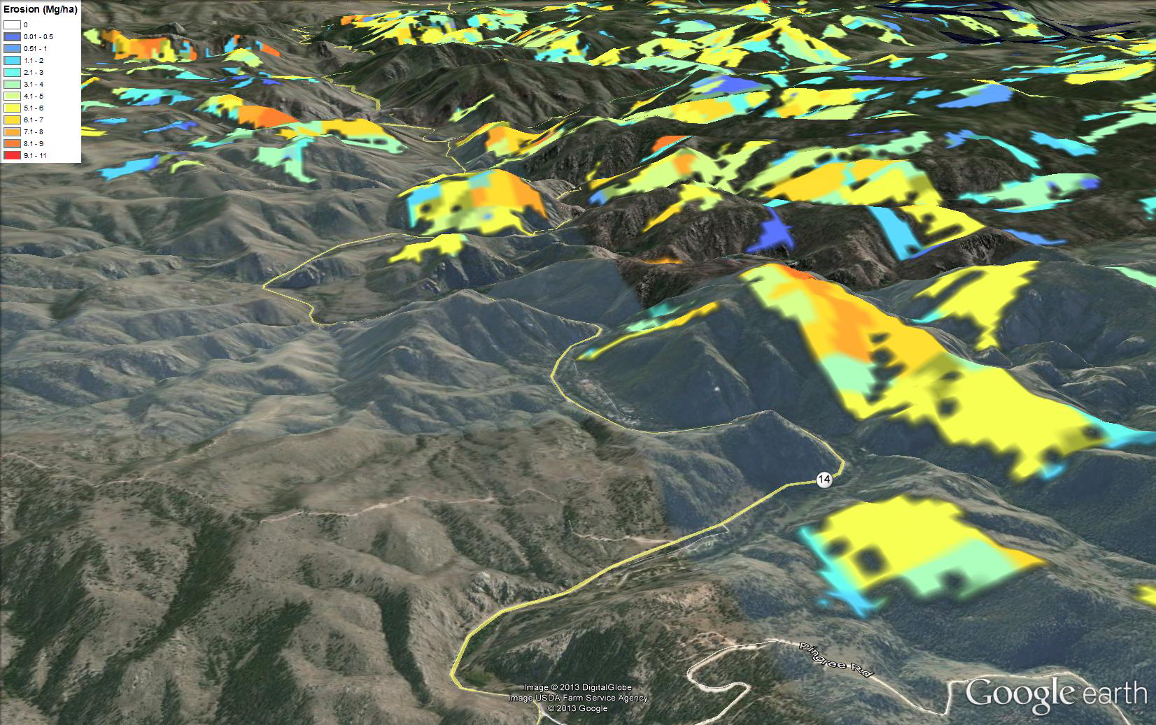
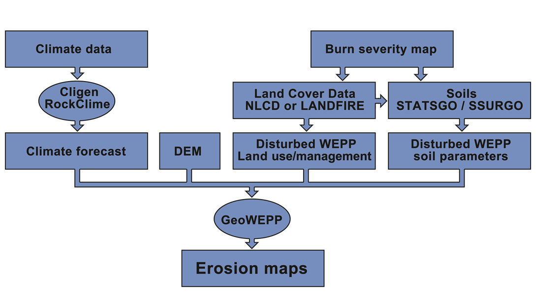
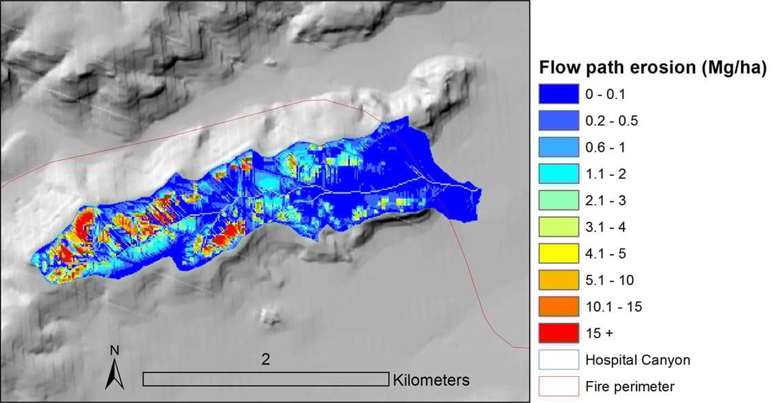
After a wildfire, Burned Area Emergency Response (BAER) Teams must rapidly assess the threat from post-fire erosion and runoff due to the removal of vegetation and litter layers. One of the first priorities of a BAER Team is to develop a burn severity map reflecting fire-induced changes in vegetative cover and soil properties. These maps are typically generated from Landsat data. Burn severity, however is not the only factor to consider. Slope, climate, soils, vegetation, and location are also important factors and can be best taken into consideration with the use of a physically based model such as the Water Erosion Prediction Project (WEPP). Researchers at MTRI have created an online spatial database for the state of Colorado to support post-fire remediation through erosion modeling. Our new website merges spatial model inputs with satellite-derived burn severity maps. Modeling datasets can be prepared rapidly so that physically based erosion models can be used to plan and prioritize post-fire remediation.
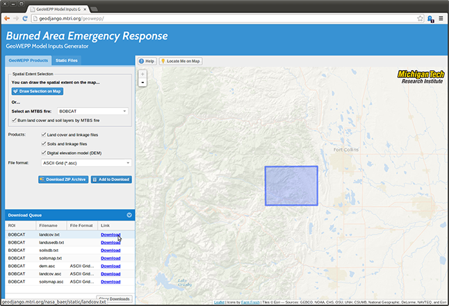
Our online database provides the input files needed to run spatial WEPP interfaces such as GeoWEPP or the Forest Service’s online WEPP watershed. Primary model inputs include a digital elevation model (DEM), climate data, soil maps, and land cover. Burn severity maps are combined with both pre-fire land cover and soil data to parameterize the model. Model parameters are based on Disturbed WEPP inputs. Disturbed WEPP is a forest service WEPP interface developed specifically for forest and rangelands.
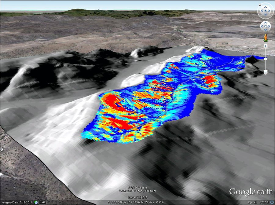
Post-fire erosion potential following the Rock House fire in Texas