
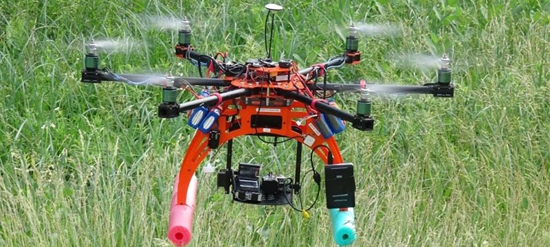
Map the World With Drones and Imagery.
1867: That's when the term photogrammetry first appeared in print, in work attributed to Prussian architect Albrecht Meydenbauer. What began as a method of measuring buildings and landscapes from photographs has evolved into a sophisticated science that transforms images into accurate maps and three-dimensional models.
Today, photogrammetrists use imagery captured by drones, aircraft, and satellites to produce detailed geospatial information. Their work supports everything from surveying and engineering to environmental monitoring, infrastructure development, and urban planning.
Michigan Tech's online Advanced Photogrammetry and Mapping with UAS Graduate Certificate builds on this legacy. You'll develop specialized skills in digital photogrammetry, image processing, and unmanned aerial systems (UAS) mapping—expertise you can apply in your current profession, use to pursue new career opportunities, or build on toward a master's degree.
Who is This Certificate For?
This certificate may be a good fit for surveying, mapping, and geospatial professionals, as well as those in engineering or geographic information management who work with aerial imagery. You'll develop specialized knowledge of photogrammetry and unmanned aerial systems (UAS) mapping for spatial data collection and analysis.
What You'll Study
You'll earn photogrammetry and UAS mapping from faculty who work in surveying and image-based geospatial technologies. Coursework connects photogrammetric principles with coding and applied mapping, while electives allow study in areas such as hydrographic mapping and LiDAR-based 3D modeling. You'll take two required courses and then choose one elective from four courses.
When planning your program, make sure you check the course registration page for the availability of classes.
Required Courses
Electives (Choose One)
This certificate is also available as an on-campus option.
Where You'll Apply Your Skills
In today’s world, the photogrammetry process (or mapping) is more important than ever. Architects and engineers — as well as federal, state, and local government agencies — depend on advanced photogrammetry to work safely and efficiently.
Earning a graduate certificate in advanced photogrammetry with mapping unmanned aerial systems (UAS) from Michigan Tech will prepare you for both UAS certification and mapping certification exams — laying the groundwork for an impactful and rewarding career in several modern workplaces.
Those with photogrammetry expertise often work as surveyors, mappers, technicians, and designers.
Possible Career Paths
- Architecture
- Cultural Heritage
- Engineering
- Geology
- Government
- Manufacturing
- Police Investigation
- Topographic Mapping
Get Started on Your Advanced Photogrammetry Certificate.
Take the next step on your educational journey at Michigan Tech. We are here to answer your questions and to help you succeed in your online program.