
Michigan Tech and the Cooperative Institute for Great Lakes Research have stepped in to ensure buoys are deployed in Lake Superior despite delays due to COVID-19.
An unexpected consequence of the COVID-19 pandemic has been the delayed deployment of Great Lakes weather and wave buoys, which provide critical weather and wave conditions information to commercial shipping, recreational boaters, anglers, swimmers and local tour boat businesses.
Stepping in to fill this gap are Michigan Tech and the Cooperative Institute for Great Lakes Research (CIGLR), a partnership between the National Oceanic and Atmospheric Administration (NOAA), University of Michigan, and 18 partner institutions, including MTU. John Lenters, an associate research scientist at Michigan Tech’s Great Lakes Research Center, requested rapid response funding from CIGLR in late May to purchase a Sofar Ocean “Spotter” wave buoy to measure wave conditions, wind velocity and surface water temperature. Michigan Tech has matched CIGLR’s funding by purchasing a second Spotter buoy.
“Numerous nearshore buoys such as those along Pictured Rocks National Lakeshore have been delayed this year due to COVID-19, despite reliance on these buoys by the National Weather Service, National Park Service and U.S. Coast Guard,” Lenters said. “This constitutes an emergency situation that puts Great Lakes communities and businesses at significant risk from the massive gap in data and the adverse impact it will have on the Weather Service’s nearshore marine forecasts.”
The Spotter buoys join a third one that Michigan Tech deployed in late April off the coast of Gay, Michigan. That buoy is being used to measure wave conditions, an important factor in the ongoing dredging of stamp sands near Buffalo Reef. The dredging project is designed to help protect local fish spawning grounds and mitigate encroachment of the white sand beaches on Grand Traverse Bay.
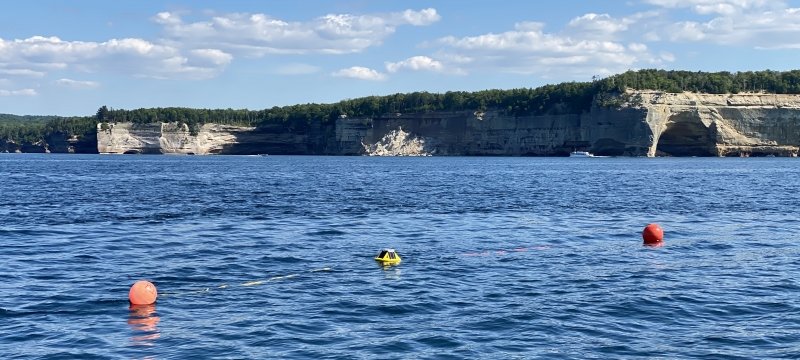
The most recent CIGLR-funded buoy was deployed near Munising on June 27, along Pictured Rocks National Lakeshore near Grand Portal Point. This scenic but treacherous stretch of rocky shoreline is frequented by kayakers and tour boats, particularly during the summer holiday season, making it a priority to deploy the buoy in advance of the Fourth of July.
“CIGLR is pleased to provide these emergency funds to MTU at the perfect time. We know just how much the public relies on buoy data for their decision-making around the Great Lakes,” said Mary Ogdahl, CIGLR program manager. “With one of the busiest ecotourism weekends of the year quickly approaching, our partnership with MTU will help ensure that people have the information they need to enjoy this national treasure in the safest way possible.”
The remaining Spotter buoy is likely to soon be deployed off Stannard Rock to the east of the Keweenaw Peninsula, since the area is a popular fishing reef not far from commercial shipping lanes.
“With all the delays this year, we thought it would be a good time to get a couple more Spotter buoys and deploy them in strategic places that benefit multiple users, including the shipping industry and recreational users like kayakers and anglers,” Lenters said. “We want to maximize the use and the public safety benefit.”
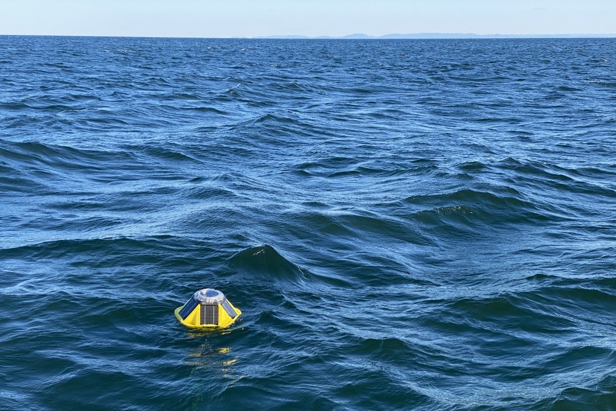
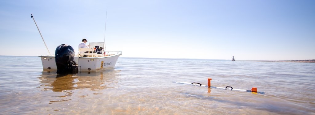
The Spotter buoys are easy to deploy from a small boat, giving them an advantage over many of the larger buoys used in the Great Lakes, which can require cranes to lower them into the water. They are about 16 inches across and 12 inches tall, and at just 12 pounds are quite lightweight. When deployed, the buoys are moored to the lake bottom using a small mooring line and anchor, along with orange marker floats and a nighttime light to alert boaters.
The buoys measure surface water temperature and wave height, direction and period (the time between waves), in addition to providing an estimate of wind speed and direction that is based on wave activity.
Michigan Technological University is an R1 public research university founded in 1885 in Houghton, and is home to nearly 7,500 students from more than 60 countries around the world. Consistently ranked among the best universities in the country for return on investment, Michigan's flagship technological university offers more than 185 undergraduate and graduate degree programs in science, technology, engineering, mathematics, computing, forestry, business, health professions, robotics, psychology, social sciences, humanities, and the arts. The rural campus is situated just miles from Lake Superior in Michigan's Upper Peninsula, offering year-round opportunities for outdoor adventure.


Comments