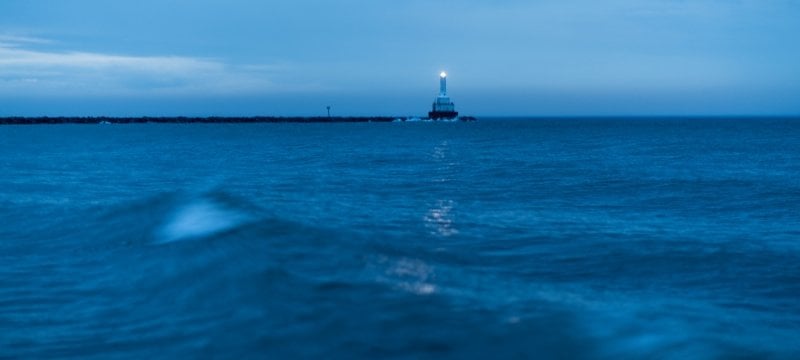

Weather-induced tsunami events can cause water levels to rise two meters in 10 minutes. A new, improved forecasting model will help Great Lakes communities prepare and respond.
Though some might consider the Great Lakes an unlikely place for tsunamis to occur, meteorological events can cause incredibly rapid lake level rises, known as meteotsunamis. And until now, Great Lakes coastal forecasting models have not been precise enough to accurately predict these events.
Michigan Technological University’s Pengfei Xue, along with collaborators at Colorado School of Mines, the National Oceanic and Atmospheric Administration (NOAA) and Argonne National Laboratory, has developed a higher-resolution model that refines the model grid from 500 meters down to just 10 meters, providing much more accurate depictions of modeled events. Additionally, the improved model’s attributes allow it to simulate key dynamic processes to predict water movement over coastal infrastructure (such as breakwaters) and during coastal inundation.
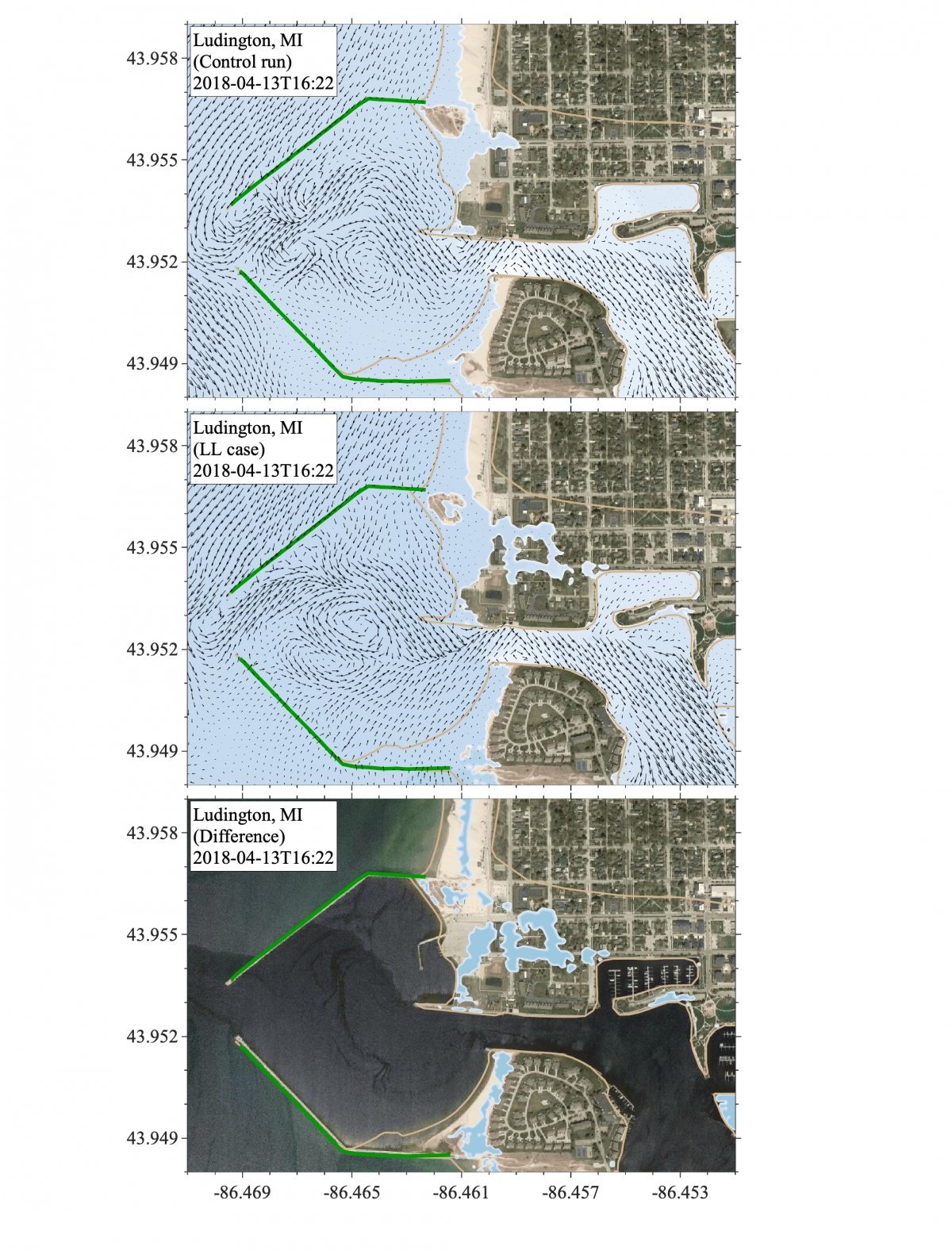
The water flood map simulated the 2018 Ludington meteotsunami depicting the control run (top), LL case (middle), and the difference in the flood area (bottom) at peak water level timestamp. Graphic credit: Pengfei Xue
“There are essential hydrodynamic processes that need to be resolved in our models of the Great Lakes to be able to simulate and predict meteotsunami-induced coastal inundations,” said Xue, an expert in developing numerical models to study hydrodynamic, climate and environmental problems in the Great Lakes. “Working with NOAA, we have developed a new model that can resolve some of the key processes including wetting and drying in low-lying zones, as well as submerging and overtopping of coastal infrastructures. This model aims to forecast the realistic hazards associated with meteotsunami events, and allows us to assess and explain meteotsunami impacts on the Great Lakes coasts.”
Rising Waters and Model Effectiveness
In April 2018, a meteotsunami hit the community of Ludington on the western coast of Michigan’s Lower Peninsula. Harbor breakwaters were overtopped and flood waters inundated the shoreline and nearby city streets.
At the time, computer model grids lacked the precision to truly forecast the water level rise, and since the Ludington station — a stilling well that measures water level fluctuations, including those induced by meteotsunamis — is inside the harbor, it also underestimated the full extent of the meteotsunami due to wave energy dissipation. Harbors by their nature are sheltering, whether because of physical features like rocks or cliffs or because of rapidly decreasing water depth.
Today, computational advances have allowed researchers to improve and validate modeling like never before.
“Up until now, our models of the Great Lakes allowed us to simulate and test for meteotsunami formation in the lakes, giving us information on timing, location and wave height at the coast,” said Eric Anderson, an associate professor at Colorado School of Mines collaborating with Xue on the project. “However, we weren’t able to properly describe the true hazards generated as those waves propagate into the coast. By extending and enhancing these models, we have demonstrated the differences between what might be predicted along the open coast of the lake and what might be measured or experienced within harbors and coastal communities.”
Under climate change, there will be more severe storms, winds and weather systems for the Great Lakes region. Coastal hazards will become more severe, especially coastal flooding. Better modeling will help coastal planners identify high-risk regions and implement preparatory measures at a local scale.
Michigan Technological University is an R1 public research university founded in 1885 in Houghton, and is home to nearly 7,500 students from more than 60 countries around the world. Consistently ranked among the best universities in the country for return on investment, Michigan's flagship technological university offers more than 185 undergraduate and graduate degree programs in science and technology, engineering, computing, forestry, business, health professions, humanities, mathematics, social sciences, and the arts. The rural campus is situated just miles from Lake Superior in Michigan's Upper Peninsula, offering year-round opportunities for outdoor adventure.


Comments