
As Great Lakes water levels rise to record heights, remotely monitoring currents and waves grows in importance.
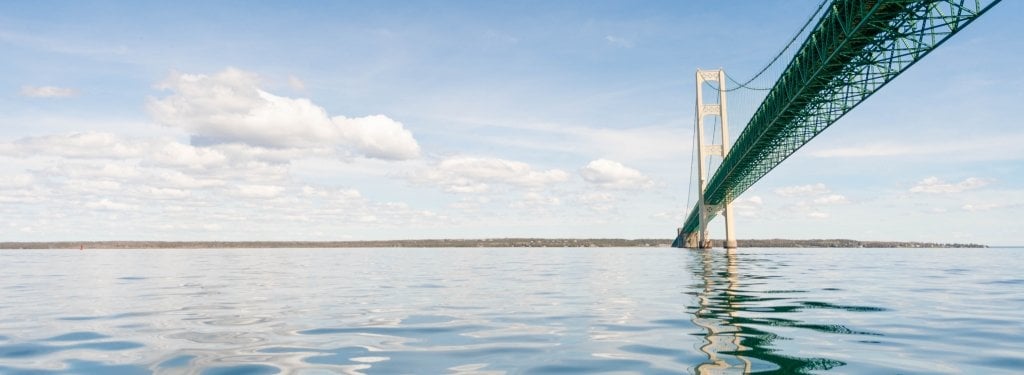
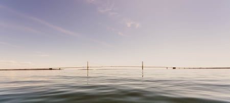
The currents of the Straits of Mackinac are known for their volatility; they have for millennia pushed the birch bark canoes of Native Americans and voyageurs alike off course and forced lake freighters aground.
The currents are also part of the complex lake system that links Lake Michigan to Lake Huron. Monitoring currents and waves in the Straits — and throughout the Great Lakes — is of great interest to scientists, municipal managers, the shipping industry, environmentalists and government agencies.

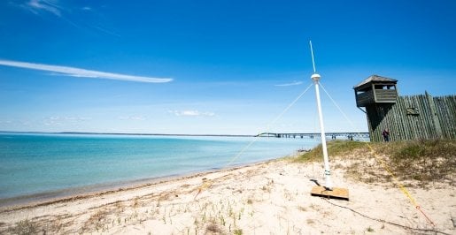
High-frequency Radar at the Straits of Mackinac
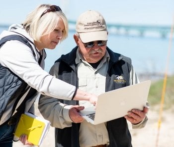
In late May, Lorelle Meadows, dean of the Pavlis Honors College at Michigan Technological University and oceanographer by training, and Guy Meadows, director of the Great Lakes Research Center, conducted the first test of a high-frequency radar system specifically tuned for use in the Great Lakes.
Great Lakes Geometry
High-frequency radar is a shore-based remote sensing system used to measure currents offshore by sending a low-power electromagnetic pulse over the water. The electromagnetic wave interacts with marine surface waves, which scatter the radar signal. By measuring the magnetic pulse bounces from marine waves back to the radar tower, researchers are able to map the speed and direction of the underlying currents.
High-frequency radar has not been implemented as a routine tool for measuring currents in the Great Lakes because, in comparison with salt water, the electromagnetic pulses travel shorter distances. High-frequency radar is effective in freshwater at shorter distances — six to eight kilometers — and there are numerous locations in the Great Lakes where coastlines narrow, providing the necessary geometry to make high-frequency radar effective.
"A lot of the infrastructure in the Great Lakes that gives us drinkable water is within a few miles of the coastline," Lorelle Meadows said. "A system like this could be valuable in different strategic locations. I could imagine it in southern Lake Huron near Port Huron and Sarnia, at the Detroit River or the Chicago waterfront — any place you want to have insight into the way the currents are moving."
Grants & Funding
The high-frequency radar pilot project, "High Frequency Radar for the Straits of Mackinac, Michigan," was funded by Great Lakes Observing System (GLOS) grant IOOS/HFR-01, Michigan Tech Proposal #1807018. GLOS is a regional association of the Integrated Ocean Observing System (IOOS), representing eight Great Lakes states.
The team, with funding from the Great Lakes Observing System (GLOS), temporarily installed two 14-foot CODAR SeaSonde high-frequency radar towers, one on each side of the Straits just west of the Mackinac Bridge. Because of its sheer size, there was the potential that the bridge would interfere with the radar signal; field testing in May proved that the bridge did not overtly interfere, a big step in moving the radar project's viability forward.
Unlike buoys, which provide single-point measurements, high-frequency radar towers use broad beams, which intersect over the water surface to create maps of an entire area.
"Each station individually can only tell you the speed at which a current is traveling toward or away from it," Lorelle Meadows said. "An individual tower only provides the radial component of the current. But by combining the two stations together we achieve the full vector."
Though not meant to replace buoys, the radar towers provide further data to gain better understanding of complex lake systems.
"The hope is to produce vector maps every half hour," Guy Meadows said. "The Straits West buoy reports conditions at a single point every 10 minutes. This system has the capability to create a new vector map of currents every 30 minutes, every day."
Next Steps
Vector maps can be used by many different interests: providing warnings to ships of currents that might force them aground or off course, giving vital information to search and rescue operations, tracking a hazard spilled into the water, or monitoring harmful algal blooms so that municipal water intakes can be shut off if necessary.
Following the pilot test, the researchers are processing data and will apply for permanent GLOS funding for the radar towers, which will operationalize this capability for the Straits and also allow them to explore further uses of the technology in freshwater.
"Our ocean coasts are instrumented with these towers," Lorelle Meadows said. "This is our opportunity for the Great Lakes coastline to be."
Michigan Technological University is an R1 public research university founded in 1885 in Houghton, and is home to nearly 7,500 students from more than 60 countries around the world. Consistently ranked among the best universities in the country for return on investment, Michigan's flagship technological university offers more than 185 undergraduate and graduate degree programs in science and technology, engineering, computing, forestry, business, health professions, humanities, mathematics, social sciences, and the arts. The rural campus is situated just miles from Lake Superior in Michigan's Upper Peninsula, offering year-round opportunities for outdoor adventure.


Comments