Michigan Tech Researches Feasibility of Drone Use in Transportation

Everyone knows what drones are, right? They have gained visibility for use in military and monitoring applications, but have a wide variety of more ‘friendly’, useful applications here at home, such as helping understand the condition of our transportation infrastructure. They are flying machines, operated for a given purpose either autonomously or remotely, that have uses well beyond their better-known reputation.
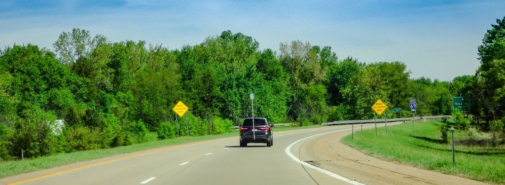
The Michigan Tech Research Institute (MTRI) is currently looking into the use of drones from a transportation perspective. MTRI scientists and faculty from the main Michigan Tech campus are using unmanned aerial vehicles —popularly called drones—to help the US Department of Transportation’s Research and Innovation Technology Administration (USDOT/RITA) and other agencies to develop low-cost, highly-efficient ways to handle tasks that range from mapping the condition of unpaved roads to understanding traffic jams and evaluating the conditions inside culverts. The research is designed to help transportation agencies save money and reduce risk to staff that would usually have to always be in a roadway, on a bridge, or inside a confined space to understand infrastructure condition.
Using high-resolution aerial imagery to understand conditions on the ground is nothing new, MTRI Senior Research Scientist Colin Brooks points out. “During the Civil War, the Union Army used balloons to take photos of Confederate earthworks,” he said. “We’re just making data-gathering quicker, easier, safer and more detailed for rapidly understanding our transportation infrastructure.”
Brooks, who specializes in remote sensing technology and geographic information systems (GIS), heads MTRI’s project team evaluating uses of unmanned aerial vehicles (UAV). But it’s a real team effort, with computer scientists programming analysis software, electrical engineers upgrading UAV flight capabilities, Michigan Tech Center for Technology and Training scientists providing gravel road and Roadsoft GIS expertise, and professors from the Geological and Mining Engineering and Sciences, Civil and Environmental Engineering, and Electrical and Computer Engineering departments sharing their knowledge.
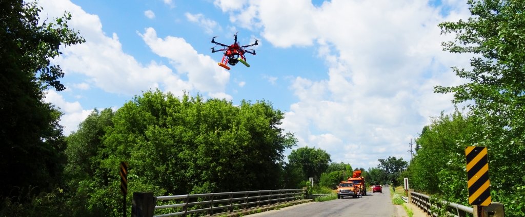
Now about those “drones.” The Michigan Tech ones look like miniature helicopters, and MTRI has two UAVs it is currently using: a Bergen hexacopter and a DJI Phantom quadcopter. The hexacopter; largest of the two, it has six blades and a four-foot rotor span. It costs $5,000 as configured for research and weighs just over 11 pounds and can fly a digital camera like a Nikon D800. The smaller UAV has four blades that spin in a two-foot diameter. It weighs only two pounds and costs just $700 and can fly smaller cameras like the Go Pro that is a favorite among action sports users.
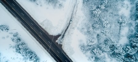
Both UAVs take full-sized high-definition digital images, with the higher resolution ones capable of better than one centimeter 3D resolution. “They can show us how many potholes are in a road and how deep they are, the degree of crown (curve) in a roadway, identify rutting conditions in a roadway, wash-boarding, drainage, and evaluate density and severity of road and bridge problems,” says Brooks. Up to now, agencies responsible for roads have been reactive, checking out problems after someone calls to complain, he explains. “This technology turns reactive responses to proactive responses through improved asset management practices,” he says.
David Dean and Richard Dobson, assistant research scientists at MTRI, specializes in interpreting aerial photographs. They see what the camera is seeing as the UAV flies over a road or bridge, or even inside a pump station or culvert; and they stitches still photos together into a three-dimensional model.
The UAVs’ flight is controlled by a “pilot” on the ground, reminiscent of remote-control model airplanes, but if they have to, they can find their own way home. They fly about 100 feet above the ground, well below the Federal Aviation Administration’s permitted ceiling of 400 feet. Both have cameras, GPS, and on-board stability systems.
And MTRI is experimenting with another, even smaller quadcopter, the open source Crazyflie, for inspecting confined spaces and seeing if it’s safe to send a person inside there. It weighs two-thirds of an ounce and costs $179. “Its controller is bigger than the vehicle,” Brooks remarks.
MTRI’s UAV work for US DOT/RITA is a $2.4 million project to analyze unpaved road conditions using remote sensing technology.
Right now, UAVs can only be used regularly by government agencies including public universities. But the FAA is expected to issue regulations by September 2015 that will allow their commercial use in the national airspace.
MTRI also represents the University in the Michigan Advanced Aerial Systems Consortium (MIAASC), which was working to get the Alpena, MI area designated one of six unmanned aerial systems FAA test sites nationwide.
“We are on the cusp of an explosion in UAV data collection that can help save money and increase safety during our inspections of roads, bridges, and confined spaces,” Brooks predicts. MTRI’s work with UAVs will lead the way.
DISCLAIMER: The views, opinions, findings and conclusions reflected in this press release are the responsibility of the authors only and do not represent the official policy or position of the US Department of Transportation/RITA, or any State or other entity.
Michigan Technological University is a public research university founded in 1885 in Houghton, Michigan, and is home to more than 7,000 students from 55 countries around the world. Consistently ranked among the best universities in the country for return on investment, Michigan’s flagship technological university offers more than 120 undergraduate and graduate degree programs in science and technology, engineering, computing, forestry, business and economics, health professions, humanities, mathematics, social sciences, and the arts. The rural campus is situated just miles from Lake Superior in Michigan's Upper Peninsula, offering year-round opportunities for outdoor adventure.
Comments